 Jatai
Jataí has served as a cattle-ranching and agricultural centre in southwestern Goiás since the nineteenth century. The city stands in Brazil’s Cerrado, a vast tropical savanna whose level to gently rolling land has made the surrounding municipality an important area for grain cultivation and livestock. The Rio Claro runs through Jataí, while the urban centre provides commerce, education and services for farms across this part of the state. Its name recalls the jataí, a native stingless bee known in Brazil for its honey. Jataí Airport on the city’s outskirts reflects the practical links between this inland centre and the wider region. Broad horizons, productive land and everyday transport infrastructure define the character of Goiás’s interior here.
Generated by AI
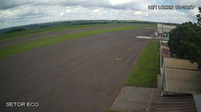

Jataí occupies a broad Cerrado plateau in southwestern Goiás, Brazil. The municipality lies in the Paraná River basin, and the Rio Claro is among the waterways shaping its rural territory. It is an important agribusiness centre in Goiás, with soybean, maize and cattle production central to the local economy; large farms share the surrounding countryside with surviving Cerrado vegetation. Jataí became a municipality in 1895 and has developed as a regional centre for services and education as well as agriculture. Its name recalls the jataí, a native stingless bee found widely in Brazil. Browse other webcams across Goiás to place this setting in a wider geographic context.
3 webcams
Goiás is best known within Brazil for the Cerrado landscapes protected in Chapada dos Veadeiros National Park. Occupying much of the country’s Central-West, the state combines savanna grasslands, scrub and gallery forests, with the Araguaia River marking part of its western frontier. Goiás City, the former state capital, preserves a colonial historic centre recognised as a UNESCO World Heritage Site. Goiânia, the present capital, supplies the state’s urban counterpoint, while pequi, a fragrant Cerrado fruit, remains central to local cooking. The dry and rainy seasons strongly shape travel and rural life. Move on to other webcams in Goiás to compare landscapes and settings around Brazil’s Central-West.
5 webcams
Brazil has served as a Portuguese colonial link between Europe and South America since the 16th century. Its immense territory extends from the Amazon River basin in the north to the Atlantic coast, with the Pantanal wetlands and Brazilian Highlands creating very different regions inland. Rio de Janeiro sits beside Guanabara Bay beneath Sugarloaf Mountain, while Brasília is known for its planned layout and modernist buildings by Oscar Niemeyer. Portuguese is the official language, and football, regional cuisines and Carnival celebrations are central to public life across the country. Continue through nearby webcams to explore different parts of Brazil.
145 webcams