 Jakovica: A1/E61/E70, Ljubljana - Koper, počivališče Lom
Tucked into the wooded karst country of south-western Slovenia, Jakovica is a place whose character is shaped by porous limestone terrain. Forested slopes, sinkholes and underground drainage are typical of this wider Slovenian landscape, where water has long carved caves and enclosed basins rather than broad surface valleys. The A1 motorway runs past Jakovica on Slovenia’s principal road corridor between Ljubljana and the port city of Koper, making this a functional link between the capital region and the Adriatic side of the country. The term karst itself derives from Slovenia’s Kras region, reflecting the country’s importance in the study of this terrain.
Generated by AI

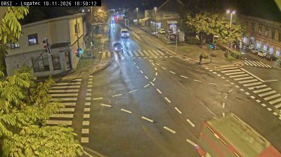

Jakovica is best known within Slovenia for its position on the karst margin north of Planinsko Polje, a seasonally flooded karst field. This small settlement lies in the Logatec administrative area, within the traditional region of Inner Carniola, where limestone ground, woodland and enclosed hollows shape the countryside. South of the village, the Unica River flows across Planinsko Polje, part of a wider landscape defined by underground watercourses and changing water levels. Jakovica suits those looking beyond Slovenia’s urban centres toward its quieter rural karst country. Continue through nearby webcams to explore different parts of the Logatec area.
1 webcam
Upravna Enota Logatec has served as a transit crossroads within present-day Slovenia since Roman times. The town of Logatec stands southwest of Ljubljana on a karst threshold, where wooded plateaus, sinkholes and underground drainage mark the transition toward the Dinaric Karst. Its location follows the old route between Aquileia and Emona, which crossed the nearby Hrušica Plateau to connect the Adriatic world with the Ljubljana Basin. The area is associated with Longaticum, a Roman roadside settlement. Forests, dispersed hamlets and strong links to central Slovenia still define its everyday character. Continue with other webcams from the area to trace how this part of Slovenia connects regionally.
7 webcams
Slovenia occupies a meeting point of the Alps, the Pannonian Plain, the Dinaric mountains and the Adriatic coast in south-central Europe. The Julian Alps rise in the northwest, where Triglav is the country’s highest mountain, while the Soča River is known for its clear turquoise water. Karst terrain has shaped caves such as Postojna Cave and the Škocjan Caves, a UNESCO World Heritage site. Ljubljana combines a riverside old town with works by architect Jože Plečnik; farther east, wine-growing regions and thermal springs add another dimension. Slovenian food reflects Alpine, Mediterranean and Balkan influences. Find related webcams in the surrounding area to build a fuller picture of Slovenia and the northern Adriatic.
768 webcams