 Inver Grove Heights: US 52: T.H.52 SB @ Briggs Dr (MP 119.5)
Inver Grove Heights is best known within Minnesota for its position along the Mississippi River, southeast of Saint Paul in the Twin Cities metropolitan area. The city extends across river bluffs, wooded corridors and lower land shaped by the broad Mississippi valley. Residential neighborhoods stand alongside transport and industrial routes that serve the eastern side of the metro area. Inver Grove Heights took its present form in 1965, when the communities of Inver Grove and Inver Grove Heights consolidated. The river remains central to local geography, while the surrounding Dakota County setting marks the shift from the urban core to Minnesota’s southeastern suburbs.
Generated by AI




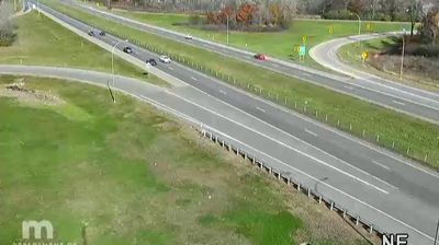





Tucked along the Mississippi River in Minnesota’s Twin Cities metropolitan area, Inver Grove Heights is a city whose character is shaped by river bluffs, woodland and its position on the southeastern edge of Saint Paul. The Mississippi National River and Recreation Area follows this important waterway through the region, linking urban communities with protected shoreline and trails. Inver Grove Heights was created in 1965 through the merger of Inver Grove and Inver Grove Heights, while the historic Rock Island Swing Bridge recalls the river’s long role in rail transport. Discover how Inver Grove Heights connects with the Mississippi corridor and the Twin Cities by browsing webcams nearby.
17 webcams
Forests, prairie and a vast lake country define much of Minnesota – these environments sustain farming, recreation and communities accustomed to long, cold winters. The Mississippi River begins at Lake Itasca in the north, then crosses the state on its way south, while Minnesota’s Lake Superior shoreline brings a markedly different, rocky Great Lakes character to the northeast. Minneapolis and Saint Paul form the Twin Cities on the river, the state’s principal urban centre. Minnesota is also home to Dakota and Ojibwe communities whose cultural presence remains central to the region. Move on to other webcams in the region to compare landscapes and settings around Minnesota.
1.2K webcams
The Atlantic, Pacific and Gulf coasts define much of the United States — their ports, fisheries and trade routes have long tied the country’s economy to the wider world. Between them, the Rocky Mountains, Great Plains and Mississippi River basin form sharply different regions, from high western ranges to broad agricultural heartlands. Cities carry much of the national story: New York’s Statue of Liberty, a gift from France dedicated in 1886, remains an enduring symbol, while Washington, DC concentrates major federal institutions. Indigenous nations have shaped these lands for millennia, and their living cultures remain essential to the country’s identity. Find related webcams in the surrounding areas to build a fuller picture of the United States.
32K webcams