 Independence: I-70 E @ 40 HWY
The I-70 interchange at Blue Ridge Boulevard occupies a built-up transport corridor on Kansas City’s eastern side, near Independence in western Missouri. Interstate 70 is one of the United States’ principal east–west highways, linking the Kansas City area with St. Louis and destinations farther east and west; Blue Ridge Boulevard carries local traffic through this suburban part of Jackson County. The area lies north of the Missouri River within the wider Kansas City metropolitan region, shaped by major roads, residential districts and commercial services. Independence, immediately east of the corridor, was an important outfitting point for travelers on the Santa Fe, Oregon and California trails. The city is also closely associated with President Harry S. Truman, whose presidential library and museum are located there.
Generated by AI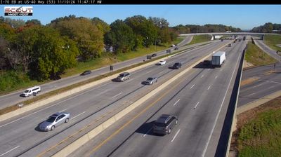



Built around the Jackson County courthouse square, Independence grew into a Kansas City metropolitan-area city closely tied to America’s westward trails. Just south of the Missouri River, it became a major outfitting point for travelers setting out on the Santa Fe, Oregon and California trails. The National Frontier Trails Museum documents that pivotal role, while the Harry S. Truman Library and Museum recalls the life and presidency of the Missouri-born president who made his home here. The historic square remains a civic focal point, with shops and public institutions gathered around its courthouse. Browse additional webcams from the surrounding area to extend your view of the Kansas City region.
11 webcams
Among the regions of the United States, Missouri stands out for the Missouri River, which gives the state its name and crosses its broad central corridor. The Mississippi forms much of the eastern border, while the forested Ozark Plateau shapes the south and rolling plains extend across the north. Near these coordinates, Columbia is home to the University of Missouri, founded in 1839 and the state’s flagship public university. The nearby Katy Trail State Park follows a former railroad route along the Missouri River, linking small river towns and farmland. Missouri’s cities also carry distinct musical and migration histories, from Kansas City jazz to St. Louis’s riverfront role. Browse additional webcams from central Missouri to extend your view of the Missouri River country.
199 webcams
The Atlantic, Pacific and Gulf coasts define much of the United States — their ports, fisheries and trade routes have long tied the country’s economy to the wider world. Between them, the Rocky Mountains, Great Plains and Mississippi River basin form sharply different regions, from high western ranges to broad agricultural heartlands. Cities carry much of the national story: New York’s Statue of Liberty, a gift from France dedicated in 1886, remains an enduring symbol, while Washington, DC concentrates major federal institutions. Indigenous nations have shaped these lands for millennia, and their living cultures remain essential to the country’s identity. Find related webcams in the surrounding areas to build a fuller picture of the United States.
32K webcams