 Inari: Tie 4 - Saariselkä, Kaunispää - maisema2
Tucked into the fell country of northern Finnish Lapland, Saariselkä is a place whose character is shaped by its position beside Urho Kekkonen National Park. This settlement in the Inari municipality stands on Highway 4, amid open heath, bogs and conifer forest characteristic of the far north. The park protects a vast tract of fells and forest, while Saariselkä functions as a base for marked trails and winter-sports infrastructure. Lake Inari lies farther north within the same municipality. The wider area belongs to Sápmi, the traditional homeland of the Sámi people. Inari municipality is the only place in Finland where Northern Sámi, Inari Sámi and Skolt Sámi are all spoken. The Siida museum in Inari village presents Sámi culture and northern Lapland’s natural environment.
Generated by AI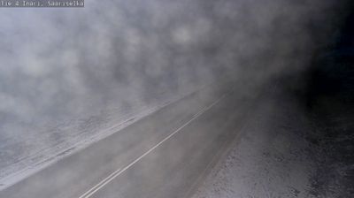


Inari straddles the Juutua River in Finnish Lapland, and the river’s outlet into Lake Inari has made the settlement an important meeting point in Finland’s Sámi homeland. Lake Inari, one of the country’s largest lakes, spreads north and east of the village in a broad mosaic of islands and open water. Inari is a key place for Sámi public life: Sajos is home to the Sámi Parliament of Finland, while Siida presents Sámi heritage and the nature of northern Lapland. Reindeer husbandry, fishing and duodji, the traditional Sámi craft, remain central references in the area’s culture. Find related webcams around Lake Inari and northern Lapland to build a fuller picture of Inari.
3 webcams
Built around river valleys, reindeer husbandry and forestry, Lapland developed into Finland’s northernmost and largest region. Long winters, forests and rounded fells define its inland character, while the Kemijoki, Finland’s longest river, drains a large part of the area. Sámi culture is central to the north of the region; Finnish settlements have also long depended on woodland work and river routes. Rovaniemi, Lapland’s administrative centre, stands at the meeting of the Kemijoki and Ounasjoki and is home to the Arktikum science centre and museum. Explore nearby webcam locations that provide complementary perspectives on Finnish Lapland.
201 webcams
The terrain of Finland ranges from low coastal plains along the Gulf of Bothnia to fells in Lapland, creating a country of forests, lakes and long northern distances. More than 180,000 lakes shape everyday life, while the Lakeland region is threaded with waterways and islands. Helsinki, on the Gulf of Finland, combines neoclassical landmarks around Senate Square with contemporary Finnish design. Farther north, the Sámi are Finland’s only recognised Indigenous people, and their culture remains closely connected to the Arctic region. In winter, snow and ice transform the north; in summer, long daylight extends outdoor life well into the evening. Continue through nearby webcams to explore different parts of Finland.
1.7K webcams