 Hasliberg: Meiringen - Alpen Tower
Hasliberg straddles a broad ridge above the Haslital in the Bernese Oberland, and its elevated position has shaped it into a string of hamlets rather than one compact settlement. Hohfluh, Wasserwendi, Goldern and Reuti occupy terraces between woodland and alpine pasture, with the Bernese Alps rising across the valley. The municipality forms the mountainside half of the Meiringen-Hasliberg recreation area and is linked to Meiringen by cable car. Muggestutz-themed family trails, built around a dwarf character, add a local storytelling element to the walking network. Pasture farming remains part of the area’s character alongside long-established mountain tourism.
Generated by AI




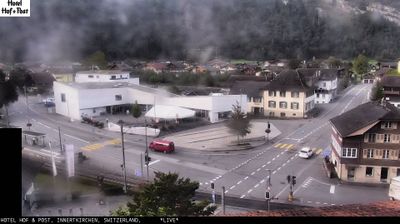


Hasliberg straddles a broad mountainside above the Aare valley in the Bernese Oberland, and that elevated position has shaped it into several settled terraces rather than a single compact centre. The municipality includes the hamlets of Hohfluh, Wasserwendi, Goldern and Reuti, spread above Meiringen on the northern side of the Alps. The Meiringen–Hasliberg cableway links Reuti with the valley town, while lifts and mountain rail facilities form part of the Meiringen-Hasliberg winter-sports area. In warmer months, marked paths connect the settlements with the high country of the Bernese Alps. Browse additional webcams from the Bernese Oberland to extend your view of the Aare valley.
6 webcams
Built around the Aare River and routes across the Swiss Plateau, Bern grew into a canton connecting the federal capital with the Bernese Oberland. Its territory extends from Jura foothills and farmland through the Aare valley to the high Alps around the Eiger, Mönch and Jungfrau. The city of Bern, Switzerland’s federal capital, preserves an Old Town inscribed on UNESCO’s World Heritage List, while Thun and Interlaken lead towards Lakes Thun and Brienz. Urban institutions, dairy farming and established alpine resorts give the canton a notably broad Swiss character. View additional webcams nearby to better understand how Bern relates to its Alpine and plateau surroundings.
230 webcams
Switzerland stretches from the Jura Mountains in the northwest to the Alps in the south, encompassing a central plateau of cities, farms and lakes. The Rhine rises in the Swiss Alps, while Lake Geneva forms part of the country’s southwestern border. Zürich, Geneva and Basel are major urban centres, yet mountain railways and passes remain central to how many regions are experienced. Four national languages—German, French, Italian and Romansh—reflect Switzerland’s distinct cantonal identities. The Matterhorn above Zermatt is among Europe’s most recognisable peaks, and the 1291 Federal Charter is closely associated with the country’s founding tradition. Continue through nearby webcams to explore different parts of Switzerland.
1.4K webcams