 Guthrie
Built around a Santa Fe Railway station, Guthrie grew into the first capital of Oklahoma Territory. The city lies in north-central Oklahoma, where Cottonwood Creek runs through a landscape of prairie and Cross Timbers woodland. Guthrie was established during the Land Run of 1889, when its population surged almost overnight; it remained the territorial and then state capital until 1910. Its National Historic Landmark district preserves an extensive concentration of late-19th- and early-20th-century commercial architecture, with red-brick blocks, ornate facades and the former Carnegie Library. Beyond the historic core, low-density neighborhoods and open land give the city a markedly different rhythm from Oklahoma City's metropolitan expanse.
Generated by AI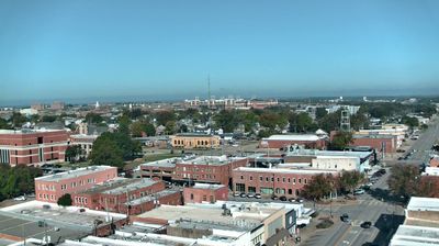


Among the cities of Oklahoma, Guthrie stands out for its unusually extensive collection of late-19th- and early-20th-century commercial architecture. Set on the prairie north of Oklahoma City, it grew rapidly during the Land Run of 1889 and became the capital of Oklahoma Territory. The city later served as Oklahoma’s first state capital, until government offices moved to Oklahoma City in 1910. Brick blocks, ornate storefronts and the Scottish Rite Temple give downtown its historic identity, while Cottonwood Creek runs through the local area. Continue through nearby webcams to explore different parts of Guthrie and central Oklahoma.
1 webcam
Oklahoma’s terrain shifts from the forested hills of its east to the open High Plains in the west, giving the state an unusually broad sweep of American landscapes. The Red River traces much of Oklahoma’s southern boundary with Texas, while the Canadian and Arkansas rivers cross its plains and valleys. Near Norman, the University of Oklahoma is a major academic and sporting presence, and its campus houses the Sam Noble Oklahoma Museum of Natural History. The cultures of 39 federally recognized Tribal Nations remain central to community life across the state. Route 66 also runs through Oklahoma, linking towns from the northeast to the Texas border. Continue through nearby webcams to explore different parts of Oklahoma.
11 webcams
The Atlantic, Pacific and Gulf coasts define much of the United States — their ports, fisheries and trade routes have long tied the country’s economy to the wider world. Between them, the Rocky Mountains, Great Plains and Mississippi River basin form sharply different regions, from high western ranges to broad agricultural heartlands. Cities carry much of the national story: New York’s Statue of Liberty, a gift from France dedicated in 1886, remains an enduring symbol, while Washington, DC concentrates major federal institutions. Indigenous nations have shaped these lands for millennia, and their living cultures remain essential to the country’s identity. Find related webcams in the surrounding areas to build a fuller picture of the United States.
32K webcams