 Grovetown: SH6 Blenheim
Among the places of Marlborough, Grovetown stands out for its position on the broad Wairau Plain, just north of Blenheim. This small settlement lies in the lower Wairau Valley, a flat alluvial area shaped by the Wairau River as it approaches Cloudy Bay. It forms part of Marlborough’s internationally known wine country, where vineyards occupy much of the plain and Sauvignon Blanc is the region’s signature variety. State Highway 1 runs through Grovetown on the principal road link between Blenheim and Picton, while the Richmond Range rises beyond the valley to the north-west. Its setting combines residential streets, productive rural land and a major inter-island transport route.
Generated by AI

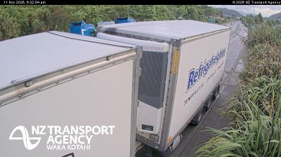

Grovetown has served as a rural settlement in Marlborough since the nineteenth century. It stands on the Wairau Plain near the Wairau River, just north of Blenheim, Marlborough’s principal town. The flat, fertile plain supports vineyards and farming, and forms part of the region behind New Zealand’s internationally recognised Sauvignon Blanc production. Broad valley land gives way to the surrounding ranges, placing Grovetown within the agricultural heart of the wider Wairau Valley. View additional webcams nearby to better understand how Grovetown and the Wairau Plain relate to the Marlborough surroundings.
2 webcams
Marlborough stretches from the Marlborough Sounds to the Wairau Valley, encompassing sheltered drowned-valley inlets and dry vineyard plains. At the northeastern tip of New Zealand’s South Island, its coast meets Cook Strait in a maze of waterways that includes Queen Charlotte Sound/Tōtaranui and Pelorus Sound/Te Hoiere. Picton is the region’s principal port and the South Island terminal for Cook Strait ferries to Wellington. Inland, the Wairau River crosses the broad valley around Blenheim, where Sauvignon Blanc has made Marlborough internationally recognised as a wine-producing region. Boating, walking and cellar-door visits reflect the sharp contrast between coast and valley. Continue through nearby webcams to explore different parts of Marlborough.
5 webcams
New Zealand combines Pacific isolation with strong ties to the wider South Pacific in a way that reflects its position between the Tasman Sea and the open Pacific Ocean. The country’s two main islands are divided by Cook Strait, while the Southern Alps run along much of the South Island and include Aoraki / Mount Cook, its highest mountain. On the North Island, volcanic terrain shapes Tongariro National Park and the central plateau; long coastlines frame cities such as Auckland and Wellington. Māori culture is central to national life, and the Treaty of Waitangi, first signed in 1840, remains a foundational document in relations between Māori and the Crown. See how New Zealand fits within the wider South Pacific by browsing webcams nearby.
482 webcams