 Greymouth: Greymouth Airport
Greymouth Airport sits on the Tasman Sea coast in New Zealand’s West Coast region, where a low, narrow coastal plain meets the foothills of the Southern Alps. The airport serves Greymouth, the West Coast’s largest town, whose position between sea and mountains has long shaped its regional role. A few kilometres north, the Grey River reaches the Tasman Sea beside Greymouth’s working port. The town expanded during the West Coast gold rushes of the 1860s and later became closely associated with coal mining, a legacy that remains central to the wider Grey Valley. Open grass, roads and low-rise development around the airfield reflect the practical, spacious character of this sparsely settled coastline.
Generated by AI
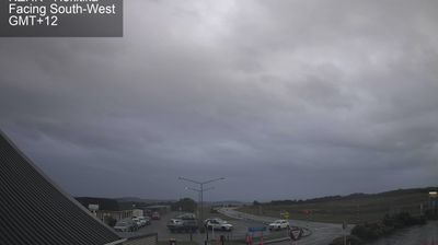

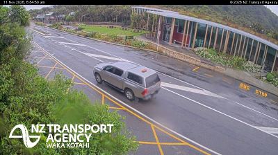

Tucked along the Tasman Sea at the mouth of the Grey River/Māwheranui, Greymouth is a place whose character is shaped by the meeting of river, working harbour and exposed West Coast. The settlement expanded during the 1860s gold rush, while coal later became central to the port’s economy. Across the river lies Cobden; inland, former mining communities and rainforest valleys extend towards the Southern Alps. The nearby Brunner Mine Historic Area commemorates the 1896 explosion in which 65 miners died. Greymouth remains the West Coast’s largest town, with rail, road and port links giving it a distinctly practical rhythm. Browse further webcams across the region to compare coastal and inland settings around New Zealand’s West Coast.
1 webcam
West Coast is best known within New Zealand for glaciers that descend from the Southern Alps toward the Tasman Sea. This narrow, rain-fed belt on the South Island’s western side runs between a wild coastline and densely forested mountains, with the Grey River meeting the sea at Greymouth, the region’s largest town. Gold and coal helped shape many West Coast settlements, while pounamu, or New Zealand jade, remains an important taonga in Māori culture. North of Greymouth, Paparoa National Park protects limestone country and the coast around Punakaiki. Browse other webcams across New Zealand’s West Coast to place this shoreline and alpine hinterland in a wider geographic context.
13 webcams
New Zealand combines Pacific isolation with strong ties to the wider South Pacific in a way that reflects its position between the Tasman Sea and the open Pacific Ocean. The country’s two main islands are divided by Cook Strait, while the Southern Alps run along much of the South Island and include Aoraki / Mount Cook, its highest mountain. On the North Island, volcanic terrain shapes Tongariro National Park and the central plateau; long coastlines frame cities such as Auckland and Wellington. Māori culture is central to national life, and the Treaty of Waitangi, first signed in 1840, remains a foundational document in relations between Māori and the Crown. See how New Zealand fits within the wider South Pacific by browsing webcams nearby.
491 webcams