 Gaspé: Chalets Nautika Gaspésie
Chalets Nautika Gaspésie occupies a low coastal strip on the Gaspé Peninsula in eastern Quebec. Its detached cabins stand above the shore in a sparsely built setting, reflecting the low-density settlement pattern found along much of this coast. The Gaspé Peninsula extends between the St. Lawrence Estuary and Chaleur Bay, where the sea has long shaped local communities and livelihoods. Small settlements and working harbours punctuate the shoreline. Gaspé also holds a central place in French-Canadian history: in 1534, Jacques Cartier erected a cross at Gaspé Bay to claim the territory for France.
Generated by AI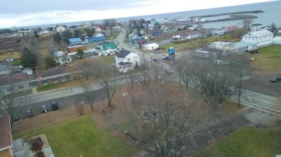

Gaspé lies along Gaspé Bay, a sheltered inlet of the Gulf of St. Lawrence, while the wooded uplands of the Gaspé Peninsula rise behind the waterfront. The town is closely associated with Jacques Cartier’s 1534 landing, when he erected a cross on the shore in the name of the French king—an episode remembered as an early French claim in what is now Canada. East of Gaspé, Forillon National Park combines forests, headlands and the meeting of Gaspé Bay with the Gulf. This is a working regional centre as well as a base for following the peninsula’s coastal routes and maritime weather. Continue with other webcams from the Gaspé Peninsula to see how this part of eastern Quebec connects regionally.
1 webcam
Quebec has served as a French-speaking heartland within Canada since the 17th century. This vast province stretches from the St. Lawrence River valley to the subarctic north, and the coordinates here lie in its extensive Canadian Shield interior. Boreal forest, lakes, wetlands and rock outcrops shape this sparsely settled part of northern Quebec, where waterways are central to travel and seasonal life. French is Quebec’s official language, while Indigenous nations maintain enduring ties to territories across the province. Quebec City’s historic centre, founded in the early French colonial era, is a UNESCO World Heritage site. Browse additional webcams from the surrounding area to extend your view of northern Quebec.
59 webcams
Canada has served as a frontier between French and British colonial powers since the 17th century. The world’s second-largest country extends from Atlantic shores to the Pacific and Arctic coasts, with the Canadian Shield, the Rocky Mountains, the Great Lakes and the St. Lawrence River shaping its vast geography. First Nations, Inuit and Métis peoples are central to Canada’s identity, while Ottawa’s Parliament Hill represents its federal political life. French remains the official language of Quebec, adding a distinct dimension to the country’s public culture. See how Canada connects across North America by browsing webcams in neighbouring regions.
3.5K webcams