 Františkov: Ještěd
Františkov has served as a settlement in the Liberec area of northern Bohemia since the 17th century. Ještěd rises above the city as the highest summit of the Ještěd–Kozákov Ridge, reaching 1,012 metres. Its unmistakable profile comes from the combined hotel and television tower designed by Karel Hubáček and completed in 1973; the building received the UIA Perret Prize. At the mountain’s foot, Liberec’s built-up districts meet open fields and the wooded slopes of the ridge. The city became a major textile-manufacturing centre in the 19th century, an industrial legacy still reflected in former factory areas and civic architecture.
Generated by AI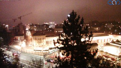






Built around scattered farmsteads on the southern edge of the Třeboň Basin, Františkov grew into a small settlement in Czechia’s South Bohemian borderland. The terrain is notably level, shaped by woods, wet meadows and the ponds that define much of the basin, rather than by the higher ridges of the nearby Novohradské Mountains. This is part of a region long associated with carp farming: South Bohemia’s network of fishponds is rooted in medieval water management and remains central to its identity. Františkov represents the slower rural side of South Bohemia, away from the principal towns. Continue with other webcams from the area to see how this part of South Bohemia connects regionally.
1 webcam
South Bohemian Region occupies a broad southern stretch of Bohemia in Czechia, reaching from the Šumava Mountains near Austria to the lowlands around České Budějovice. The Vltava flows north through this region, while the Třeboň area is renowned for its centuries-old network of fishponds and carp farming. Český Krumlov, set in a bend of the Vltava, is a UNESCO World Heritage Site known for its historic centre and castle complex. The regional capital, České Budějovice, is also home to the Budweiser Budvar brewery. Browse additional webcams from the surrounding area to extend your view of South Bohemia.
103 webcams
The terrain of Czechia ranges from fertile lowlands in southern Moravia to mountain ridges along the northern frontier, giving this Central European country a distinctly varied geography. The Vltava runs through Prague before joining the Elbe, while the Krkonoše form part of the border with Poland and include Sněžka, Czechia’s highest mountain. Prague’s historic centre, with Prague Castle and Charles Bridge, reflects the city’s long role as a political and cultural centre. Beyond the capital, Bohemia is known for spa towns and brewing, and Moravia for wine-growing traditions. View additional webcams nearby to better understand how Czechia relates to its Central European surroundings.
1.4K webcams