 Fiordland Community: Kepler Track, Fiordland National Park
Tucked into the rugged mountains of Fiordland National Park, Fiordland Community is a place whose character is shaped by steep, glaciated terrain. Near Borland Saddle in the southern reaches of the Southern Alps, this is remote Southland high country of rocky ridges, sharply cut valleys and extensive wilderness. Fiordland National Park is New Zealand’s largest national park and forms part of Te Wāhipounamu, inscribed on UNESCO’s World Heritage List in 1990. Limited access through the interior reinforces the scale of this mountain region, far removed from the settled landscapes of southern New Zealand.
Generated by AI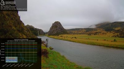

Among the communities of Southland, Fiordland Community stands out for its position on Lake Te Anau within Fiordland National Park. This is a remote corner of the Te Wāhipounamu World Heritage Area, a vast protected region of southwest New Zealand recognised by UNESCO for its exceptional natural heritage. Lake Te Anau, the South Island’s largest lake, is closely associated with the Milford Track: walkers travel by boat from Te Anau Downs to reach the trail’s starting point at Glade Wharf. Forested shores, deep water and the park’s road-light wilderness give the area a distinctly untamed character. Browse other webcams across Fiordland and Southland to place this setting in a wider geographic context.
3 webcams
Southland occupies New Zealand’s southern mainland, between Fiordland’s mountains and the waters of Foveaux Strait. Its western reaches are shaped by Fiordland National Park, where deep fiords, rainforest and lakes such as Te Anau define a far more rugged character than the region’s eastern plains. The Waiau River links the inland lakes with the coast, while Rakiura/Stewart Island lies beyond the strait. Farming remains central to Southland’s identity, alongside the celebrated Bluff oyster fishery. Continue through nearby webcams to explore different parts of Southland.
33 webcams
New Zealand combines Pacific isolation with strong ties to the wider South Pacific in a way that reflects its position between the Tasman Sea and the open Pacific Ocean. The country’s two main islands are divided by Cook Strait, while the Southern Alps run along much of the South Island and include Aoraki / Mount Cook, its highest mountain. On the North Island, volcanic terrain shapes Tongariro National Park and the central plateau; long coastlines frame cities such as Auckland and Wellington. Māori culture is central to national life, and the Treaty of Waitangi, first signed in 1840, remains a foundational document in relations between Māori and the Crown. See how New Zealand fits within the wider South Pacific by browsing webcams nearby.
495 webcams