 Dobrova-Polhov Gradec: Polhov Gradec
Polhov Gradec has served as a market settlement in the Polhov Gradec Dolomites since the late 15th century. Its compact centre lies in the valley of the Božna, amid the rounded, wooded hills of this pre-Alpine region west of Ljubljana. The older core is marked by Polhov Gradec Manor, a longstanding local landmark that houses the Museum of Post and Telecommunications. The parish Church of the Nativity of Mary and clusters of farmhouses give the settlement a distinctly rural scale, while meadows and forested slopes begin close to the houses. Polhov Gradec is closely associated with the wider Polhov Gradec Dolomites, a landscape of small settlements, upland farms, walking routes and cycling roads.
Generated by AI


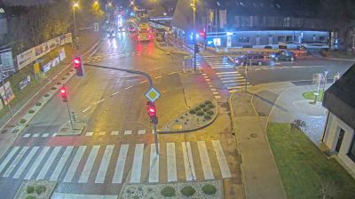

Dobrova-Polhov Gradec straddles the transition between the Polhov Gradec Dolomites and the Ljubljana Basin in central Slovenia, and that setting has kept its settlements closely tied to fields, forest and winding local roads. The municipality lies west of Ljubljana, yet its terrain soon becomes distinctly rural, with wooded ridges enclosing scattered hamlets. In Dobrova, the Church of the Assumption is an established pilgrimage landmark, while Polhov Gradec retains an older local centre around its manor. The area reflects the quieter upland edge of Slovenia’s capital region. Browse other webcams across central Slovenia and the Ljubljana region to place this setting in a wider geographic context.
1 webcam
Upravna Enota Ljubljana stretches from the Sava River to the wooded Dinaric foothills south of the capital, encompassing the lowlands of the Ljubljana Basin and the city’s suburban fringe. At its centre lies Ljubljana, Slovenia’s political and cultural capital, arranged along the Ljubljanica River. The riverfront is defined by the Triple Bridge and the Central Market, both closely associated with architect Jože Plečnik, while Ljubljana Castle stands on the hill above the old town. Beyond the urban core, settlements, farmland and forest connect the basin with karst country to the south. Explore nearby webcam locations that provide complementary perspectives on Ljubljana and central Slovenia.
67 webcams
Slovenia occupies a meeting point of the Alps, the Pannonian Plain, the Dinaric mountains and the Adriatic coast in south-central Europe. The Julian Alps rise in the northwest, where Triglav is the country’s highest mountain, while the Soča River is known for its clear turquoise water. Karst terrain has shaped caves such as Postojna Cave and the Škocjan Caves, a UNESCO World Heritage site. Ljubljana combines a riverside old town with works by architect Jože Plečnik; farther east, wine-growing regions and thermal springs add another dimension. Slovenian food reflects Alpine, Mediterranean and Balkan influences. Find related webcams in the surrounding area to build a fuller picture of Slovenia and the northern Adriatic.
768 webcams