 Daren
The southern reaches of Taiwan’s Central Mountain Range define the setting of Daren Township — wooded hills and narrow corridors of settlement shape this rural part of Pingtung County. Daren stands on the southern connection between Taiwan’s east and west sides, with Provincial Highway 9 crossing the mountain country toward Taitung. Its communities are closely associated with the Paiwan, one of Taiwan’s Indigenous peoples, whose culture remains an important part of the region’s identity. The township stretches from upland terrain toward the Pacific coast, where the island’s southern mountains meet the sea. Roads, forest and small settlements, rather than dense urban development, set the local rhythm.
Generated by AI


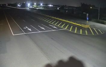



Daren has served as a Paiwan homeland in southeastern Pingtung since before Taiwan’s modern administrative era. Set on the island’s far southeast, the township runs from forested slopes of the Central Mountain Range toward the Pacific coast, where Pingtung meets Taitung County. Provincial Highway 9, the South-Link Highway, passes through this rugged corridor and is the main overland route linking southern Taiwan with the east coast. Paiwan culture remains central to local identity, alongside small settlements and agricultural land shaped by the steep terrain. Continue to other webcams in Pingtung County to compare coastal and mountain settings around Daren.
2 webcams
Built around farming settlements of the East Rift Valley and Pacific coast, Taitung County grew into Taiwan’s broad southeastern county. The Central Mountain Range forms its western spine, while the county reaches east to the Pacific and includes Green Island and Orchid Island. The East Rift Valley supports rice cultivation and links Taitung City with smaller rural townships; the coast is marked by the meeting of mountains and sea. Indigenous peoples, including the Amis, Bunun, Paiwan, Puyuma and Tao, are integral to local life, languages and traditions. In Taitung City, the National Museum of Prehistory introduces the archaeology and Indigenous cultures of eastern Taiwan. View additional webcams nearby to better understand how Taitung County relates to Taiwan’s southeastern landscapes.
2 webcams
Taiwan's terrain ranges from fertile plains along the western coast to steep mountains in the interior, concentrating much of its population on the lowlands. The Central Mountain Range runs through the island, while the Pacific meets a more rugged eastern shoreline and the Taiwan Strait lies to the west. Taipei combines contemporary city life with major cultural institutions: the National Palace Museum preserves an extensive collection of Chinese imperial art. Across Taiwan, night markets are central to everyday eating, serving regional snacks alongside familiar staples. Tea cultivation, especially in upland areas, remains an enduring part of the island's food culture. Explore nearby locations that provide complementary perspectives on Taiwan.
94 webcams