 Charlotte: Bojangles Coliseum
Charlotte straddles a low Piedmont ridge between the Catawba and Yadkin–Pee Dee river basins in North Carolina, a position that helped make the city a rail and commercial centre. Bojangles Coliseum, completed in 1955 as Charlotte Coliseum, is among the city’s most recognisable mid-century buildings. Its broad circular dome was designed by Charlotte architect A. G. Odell Jr., and the arena has staged concerts, sporting events and community gatherings for decades. It was the original home of the NBA’s Charlotte Hornets from the team’s 1988 debut until 2002. Together with Ovens Auditorium, it forms the Bojangles Entertainment Complex east of Uptown.
Generated by AI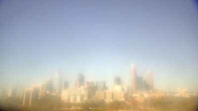









Tucked into North Carolina’s rolling Piedmont, Charlotte is a city whose character is shaped by low ridges and creek-cut valleys. The Catawba River flows west of the urban core, while Lake Norman, a Catawba reservoir, extends north toward the foothills. In Uptown, the central business district, Bank of America’s headquarters and the NASCAR Hall of Fame reflect Charlotte’s national roles in finance and motorsport. Named in 1768 for Queen Charlotte of Mecklenburg-Strelitz, the city grew from a colonial crossroads into North Carolina’s largest metropolis. Fourth Ward preserves streets of late-19th-century houses close to the modern skyline. Explore nearby webcam locations that provide complementary perspectives on Charlotte and the North Carolina Piedmont.
4 webcams
Among the regions of the United States, North Carolina stands out for its sweep from the Blue Ridge Mountains across the Piedmont to the Atlantic’s barrier islands. The coordinates lie in the central Piedmont, where rolling, wooded terrain and growing communities link the mountain country with the coastal plain. To the west, the Blue Ridge Parkway follows the Appalachian highlands; eastward, the Outer Banks form a long sandy edge facing the Atlantic. North Carolina holds an enduring place in aviation history: the Wright brothers made the first successful powered flight near Kitty Hawk in 1903. Barbecue traditions and university towns add further character to this state of distinct regions. Discover North Carolina in its wider Southeastern setting by browsing webcams in nearby areas.
58 webcams
The Atlantic, Pacific and Gulf coasts define much of the United States — their ports, fisheries and trade routes have long tied the country’s economy to the wider world. Between them, the Rocky Mountains, Great Plains and Mississippi River basin form sharply different regions, from high western ranges to broad agricultural heartlands. Cities carry much of the national story: New York’s Statue of Liberty, a gift from France dedicated in 1886, remains an enduring symbol, while Washington, DC concentrates major federal institutions. Indigenous nations have shaped these lands for millennia, and their living cultures remain essential to the country’s identity. Find related webcams in the surrounding areas to build a fuller picture of the United States.
32K webcams