 Charleston
 lies along the Kanawha River, where wooded Appalachian hills close around a compact state-capital city. The Elk River joins the Kanawha within the city, while highways and rail corridors follow the narrow valley that has long shaped local growth. As West Virginia’s capital, Charleston is home to the gold-domed State Capitol, completed in 1932, and the West Virginia State Museum. Its downtown combines government institutions with offices, shops and riverfront spaces, while residential districts extend up the surrounding slopes. The city also reflects the Kanawha Valley’s industrial past, from salt production to chemical manufacturing. Charleston remains both a working administrative centre and an introduction to the terrain and transport routes of central West Virginia.
Generated by AI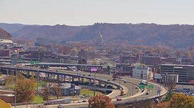

The landscape around Charleston is a narrow, wooded Appalachian river valley, which has shaped both the urban form and local economy. West Virginia’s capital extends along the Kanawha River, with the Elk River meeting it close to downtown. The West Virginia State Capitol, completed in 1932 and topped by a gold-leaf dome, is the city’s principal civic landmark. During the 19th century, the Kanawha Valley was an important salt-producing area; chemical manufacturing later became a major part of its industrial identity. Capitol Market, based in a restored railroad depot, links local food producers with the downtown district. Continue through nearby webcams to explore different parts of the Kanawha Valley.
2 webcams
Among the states of the United States, West Virginia stands out for its deeply folded Appalachian terrain and enduring mountain identity. The Allegheny Mountains, forested ridges, and narrow river valleys shape much of the state, while the New River cuts through the dramatic gorge protected by New River Gorge National Park and Preserve. Coal mining has long influenced local communities and the state’s industrial heritage. West Virginia became a separate state during the Civil War in 1863. Continue through nearby webcams to explore different parts of West Virginia.
11 webcams
The Atlantic, Pacific and Gulf coasts define much of the United States — their ports, fisheries and trade routes have long tied the country’s economy to the wider world. Between them, the Rocky Mountains, Great Plains and Mississippi River basin form sharply different regions, from high western ranges to broad agricultural heartlands. Cities carry much of the national story: New York’s Statue of Liberty, a gift from France dedicated in 1886, remains an enduring symbol, while Washington, DC concentrates major federal institutions. Indigenous nations have shaped these lands for millennia, and their living cultures remain essential to the country’s identity. Find related webcams in the surrounding areas to build a fuller picture of the United States.
32K webcams