 Ceahlau: Ceahlau Toaca Weather Station
Among the mountain places of Neamț County, the Toaca Weather Station in the Ceahlău Massif stands out for its position on a 1,904-metre summit. The massif rises in Romania’s Eastern Carpathians and is protected as Ceahlău National Park, with steep slopes, rock formations and forested ridges. Ocolașul Mare, at 1,907 metres, is its highest peak, while Lake Izvorul Muntelui lies to the west. Its upper slopes mark the transition from wooded lower ground to a rocky crest. Mountain routes from Durău lead toward Toaca, where the station serves an important practical purpose. Ceahlău also holds a deep place in Romanian Orthodox tradition: pilgrims gather on the mountain for the Feast of the Transfiguration.
Generated by AI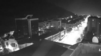

Lake Izvorul Muntelui defines the setting of Ceahlău — created on the Bistrița River behind Bicaz Dam, it gives this mountain settlement a long shoreline beneath the Ceahlău Massif. The commune lies beside Ceahlău National Park, a protected Carpathian area known for forested slopes, rock formations and high meadows. Trails from nearby Durău lead into the massif, whose Toaca Peak is among its best-known landmarks. Durău Monastery adds a cultural note: its church has murals painted in the 1930s by students of Romanian artist Nicolae Tonitza. Browse additional webcams from the surrounding area to extend your view of Ceahlău and the Eastern Carpathians.
1 webcam
Neamț occupies a Carpathian mountain-and-foothill zone in northeastern Romania. Forested ridges of the Eastern Carpathians give way to the valleys of the Bistrița and Moldova rivers, creating a region where settlements, pastureland and dense woodland meet. The Ceahlău Massif is Neamț’s most recognisable mountain landmark, while the Bicaz Gorge nearby cuts dramatically through limestone on the route toward Transylvania. Around Târgu Neamț, the medieval Neamț Fortress and the historic Neamț Monastery reflect the area’s long connection with Moldavia. Continue through nearby webcams to explore different parts of Neamț.
3 webcams
The terrain of Romania ranges from the Carpathian Mountains in the centre to the Danube Delta wetlands in the east, creating contrasts between highland forests, fertile plains and reed-filled waterways. The Danube reaches the Black Sea here, and its delta supports abundant bird and aquatic life. Transylvania is marked by medieval towns such as Sibiu and Brașov, while Bucharest is home to the monumental Palace of Parliament, commissioned during the communist era. Orthodox monasteries, folk traditions and regional cuisines add further layers to a country shaped by several historic provinces. Discover other points of interest through webcams located across Romania.
142 webcams