 Bang Kaeo
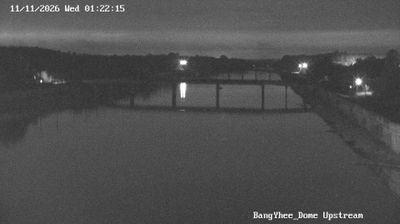
Tucked into the lowland interior of Phatthalung Province, Tha Maduea is a place whose character is shaped by tropical vegetation and road-linked settlement. It lies in southern Thailand on the Malay Peninsula, in a province defined more by small communities than by large urban centres. Mature trees and dense shrubs form a green edge around local properties, while a paved road creates a clear route through the settled landscape. Buildings are dispersed among heavily planted plots, giving the area a rural-residential character. Tha Maduea represents the everyday, lived-in side of southern Thailand, where roadside connections link homes and small settlements across the provincial lowlands.
Generated by AI


Tha Maduea combines a quiet rural setting with Phatthalung’s broader southern Thai identity, reflecting its position in lowlands between the Nakhon Si Thammarat Range and the Songkhla Lake basin. Phatthalung Province is shaped by the Songkhla Lake system, a large lagoon complex shared with neighbouring southern provinces, while forested highlands rise to the west. The province is closely associated with Nora, southern Thailand’s distinctive dance-drama tradition, which was added to UNESCO’s Representative List of Intangible Cultural Heritage in 2021. Continue through nearby webcams to explore different parts of Phatthalung Province.
1 webcam
Phatthalung Province is best known within Thailand for the Thale Noi wetlands, an important bird habitat in the Songkhla Lake system. In southern Thailand, the province runs from the lake’s western lowlands into forested hills, with farming and fishing central to life in many districts. Thale Noi Non-Hunting Area is associated with waterbirds and broad seasonal spreads of lotus, while its waterways support local communities. Phatthalung is also closely connected with Nora, southern Thailand’s expressive dance-drama tradition, which UNESCO has inscribed on its Representative List of Intangible Cultural Heritage. The provincial capital is a useful starting point for exploring the lake basin and surrounding countryside. Find related webcams in the surrounding area to build a fuller picture of Phatthalung Province.
1 webcam
Thailand stretches from the mountains along its northern borders to the Malay Peninsula, encompassing fertile central plains, river deltas and long tropical coasts. The Chao Phraya River runs through Bangkok, where the Grand Palace and Wat Phra Kaew remain central symbols of the Thai monarchy and Buddhist tradition. North of the capital, Ayutthaya’s temple ruins recall the former Siamese kingdom; farther south, the Andaman Sea and Gulf of Thailand frame islands, fishing ports and beach resorts. Thai food, from street stalls to regional kitchens, is inseparable from daily life, while Songkran marks the traditional New Year each April. Browse additional webcams from the surrounding area to extend your view of Thailand.
147 webcams