 Balimo: Balimo Airport PG-0224
Tucked into the low-lying wetlands of Papua New Guinea’s Western Province, Balimo is a place whose character is shaped by the Aramia River and its surrounding floodplain. It is the administrative centre of the Delta Fly District, in a sparsely populated part of the country where waterways and air connections are central to everyday travel. Balimo Airport provides an important link with other Papua New Guinean centres. The town lies within the homeland of Gogodala communities, whose cultural traditions include large communal longhouses and distinctive carved art. This is a remote river settlement where public services, transport and village life meet at the edge of an extensive wetland region.
Generated by AI


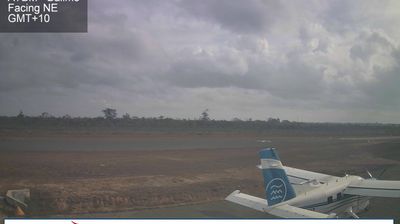

The Aramia River defines the setting of Balimo — this lowland town stands in the waterlogged interior of Western Province, within the wider Fly River basin. Balimo is the administrative centre of Middle Fly District, giving it an important civic role across a sparsely settled part of Papua New Guinea. Roads are limited in this terrain, so river travel and the local airstrip are important practical links. The surrounding country is characterised by rainforest, swamps and communities for whom sago is an important staple, rather than the highland scenery often associated with Papua New Guinea. Explore further webcams across Western Province to understand Balimo within the geography of the western lowlands.
2 webcams
Western Province is best known in Papua New Guinea for the Fly River, one of the country’s great waterways. The province occupies the nation’s far west, where broad lowlands run from the Indonesian border towards the Gulf of Papua and give way to wetlands, floodplains and forest. Flowing from the Star Mountains, the Fly is a vital transport corridor for remote river communities; its watershed also includes the Ok Tedi, associated with the major mine near Tabubil. Daru, the provincial capital, stands on an island near the Torres Strait. Sago remains an important staple in many lowland communities. Browse webcams around Western Province to understand its place in Papua New Guinea’s wider river country.
7 webcams
Among the nations of Oceania, Papua New Guinea stands out for its exceptional linguistic diversity, with more than 800 indigenous languages spoken across its communities. The country occupies the eastern half of New Guinea and includes many islands, where the Owen Stanley Range rises behind the south-eastern coast and the Sepik River winds through the north. Port Moresby is the capital, while Mount Wilhelm is the country’s highest mountain. Ceremonial traditions, carved art and elaborate masks remain important expressions of community identity, notably in the Sepik region. Its rugged terrain has long made travel between places more complex than maps suggest. View additional webcams nearby to better understand how Papua New Guinea and the wider Melanesian region relate to their surroundings.
38 webcams