 Bad Bleiberg: Villacher Alpenstraße - Rosstratte

The Dobratsch massif defines the setting of Bad Bleiberg — its high, partly forested slopes rise above this former mining community in Carinthia. At 2,166 metres, Dobratsch is a prominent limestone mountain of the Gailtal Alps and the centrepiece of Dobratsch Nature Park. The Villacher Alpenstraße climbs to Rosstratte, a high plateau at 1,732 metres below the summit, where roads give way to open mountain ground and walking routes. Bad Bleiberg developed around lead and zinc mining; its mine closed in 1993, but the town retains that industrial heritage. The mountain also has pilgrimage churches near its summit, reflecting Carinthia’s German- and Slovenian-speaking traditions.
Generated by AI
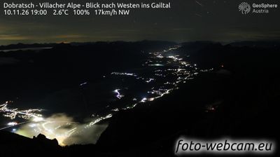



Bad Bleiberg combines a former mining identity with a calm spa character in a way that reflects its position in the Gailtal Alps of Carinthia. Lead and zinc mining shaped the settlement for centuries, and the Terra Mystica mine tour preserves part of that underground heritage. Thermal water later gave Bad Bleiberg its status as a health resort, adding a different rhythm to this narrow alpine valley. The nearby Dobratsch massif and Dobratsch Nature Park place the town within a distinctive Karinthian mountain setting. Move on to other webcams in Carinthia to compare alpine valleys and settings around Bad Bleiberg.
4 webcams
Carinthia is best known within Austria for its warm Alpine lakes, especially Lake Wörthersee. Austria’s southernmost province lies along the eastern Alps, where the Drava River runs through broad valleys below mountain slopes. Lake Millstatt and Lake Ossiach provide further waterside focal points, while the rounded Nock Mountains shape much of the interior. Klagenfurt, the provincial capital, is recognised for the Lindwurm fountain on Neuer Platz, a long-standing symbol of the city. Discover other points of interest through webcams located across Carinthia.
352 webcams
Austria stretches from the Bohemian Massif along its northern edge to the Carnic Alps on the Italian border, encompassing high Alpine ranges and the Danube lowlands. The Danube links cities including Linz and Vienna, while the Grossglockner, at 3,798 metres, is the country’s highest mountain. Vienna developed for centuries as the seat of the Habsburg court, leaving imperial architecture around the Hofburg and Schönbrunn Palace. Salzburg is closely associated with Wolfgang Amadeus Mozart, who was born there in 1756. Alpine Tyrol, wine-growing areas east of Vienna and the lakes of Salzkammergut add markedly different regional identities. Browse other webcams across Austria to place this setting in a wider geographic context.
3.1K webcams