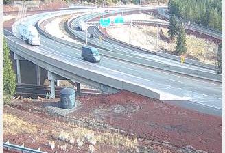
 Ashland: I-5 at Crowson Rd - Siskiyou Chain Up Area
Ashland sits in the Bear Creek Valley of southern Oregon, where Interstate 5 rises from the Rogue Valley toward the Siskiyou Mountains. Close to the California border, the city is known for the Oregon Shakespeare Festival, founded in 1935 and now a defining part of Ashland’s cultural life. Lithia Park follows Ashland Creek through the center, linking landscaped grounds with the wooded foothills above town. This section of I-5 belongs to the principal north–south route between Oregon and northern California, marking the transition from the broad Rogue Valley to the mountain roads of the Siskiyou range.
Generated by AI




Few cities in Oregon have a history as closely tied to Shakespearean theatre as Ashland. Set at the foot of the Siskiyou Mountains on the southern edge of the Rogue Valley, the city grew around a milling settlement before becoming known for the Oregon Shakespeare Festival, founded in 1935. Its stages have made downtown an enduring cultural centre, while Lithia Park follows Ashland Creek from the centre toward wooded hillsides. Independent bookshops, galleries and restaurants share the compact core with Southern Oregon University. Nearby Mount Ashland and the wine-growing Rogue Valley connect the city to southern Oregon’s outdoor and food culture. Find related webcams in the Rogue Valley and surrounding Siskiyou foothills to build a fuller picture of Ashland.
7 webcams
The Cascade Range and high desert define much of Oregon, shaping a state where forestry, farming, hydropower and outdoor recreation are central to regional life. The Columbia River forms much of its northern border, while the Willamette Valley supports fertile farmland between the Cascades and the Coast Range. Oregon’s Pacific shore is marked by long beaches, headlands and working coastal towns, and Crater Lake preserves the deep caldera of Mount Mazama in the south. Oregon City is associated with the historic end of the Oregon Trail, a reminder of the migration that transformed the nineteenth-century American West. See how Oregon connects with the wider Pacific Northwest by browsing webcams nearby.
890 webcams
The Atlantic, Pacific and Gulf coasts define much of the United States — their ports, fisheries and trade routes have long tied the country’s economy to the wider world. Between them, the Rocky Mountains, Great Plains and Mississippi River basin form sharply different regions, from high western ranges to broad agricultural heartlands. Cities carry much of the national story: New York’s Statue of Liberty, a gift from France dedicated in 1886, remains an enduring symbol, while Washington, DC concentrates major federal institutions. Indigenous nations have shaped these lands for millennia, and their living cultures remain essential to the country’s identity. Find related webcams in the surrounding areas to build a fuller picture of the United States.
32K webcams