 Ararat: Ararat & District Pony Club
Ararat lies along a broad inland valley on Victoria’s western plains, where the Grampians rise to the west and farmland surrounds the town. Gold discovered by Chinese miners in 1857 transformed the settlement during the Victorian gold rush and gave Ararat a lasting place in the region’s story. Ararat & District Pony Club belongs to the town’s open, semi-rural edge, where paddocks and mature trees meet residential streets. Beyond the former goldfields, Ararat remains a service centre for surrounding farming communities and for travel between Melbourne and western Victoria. Its heritage includes J Ward, a former gaol later used as a hospital for criminally insane patients.
Generated by AI


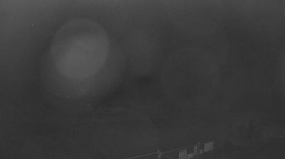

Ararat straddles the upper Hopkins River in western Victoria, where the plains meet the Grampians (Gariwerd) ranges and routes through the Wimmera and Western District converge. The town grew rapidly after Chinese prospectors found alluvial gold here in 1857, a story central to its identity. Broad streets retain the practical scale of a nineteenth-century service centre, while the former Aradale asylum and J Ward recall a more complex institutional past. Mount Langi Ghiran rises east of town, and the Grampians lie to the west, placing Ararat between vineyard country, farms and sandstone ranges. Browse other webcams across western Victoria to place Ararat in a wider geographic context.
1 webcam
Among Australia’s regions, Victoria stands out for the remarkable variety packed between the Murray River and Bass Strait. The state combines fertile northern plains, the Central Victorian Goldfields, the forested Great Dividing Range and a long southern coast. Bendigo and Ballarat grew rapidly during the gold rushes of the 1850s, while Melbourne developed into Victoria’s cultural and economic centre. Along the southwest, the Great Ocean Road follows a dramatic stretch of coastline, contrasting with the farmland and river country inland. See how Victoria belongs within southeastern Australia by browsing webcams across the region.
326 webcams
Australia’s terrain extends from tropical rainforests in the northeast to arid plains in the interior, producing dramatic climatic contrasts. The Great Dividing Range follows much of the eastern coast, while the Great Barrier Reef lies off Queensland in the Coral Sea and Uluru rises from the central desert. Aboriginal and Torres Strait Islander peoples maintain living cultures whose connections to Country long predate European settlement. In Sydney, the sail-like Opera House, completed in 1973, stands beside one of the world’s best-known harbours. Discover further points of interest through webcams located across Australia.
1.7K webcams