 Alexandroupolis
Alexandroupoli occupies a low coastal strip on the Thracian Sea in northeastern Greece. The modern city spreads around a working port and marina, with a long seafront at the centre of its urban life. Its landmark lighthouse, erected in the 19th century, stands on the waterfront and has become the city’s familiar emblem. Ferries from the port link the mainland with Samothrace, the mountainous Aegean island offshore. Alexandroupoli is also the administrative capital of the Evros regional unit, close to the Evros River and the Turkish border. This position gives the city a distinctly borderland character, shaped by maritime connections and the wider landscape of Greek Thrace.
Generated by AI
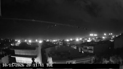

Among the cities of Macedonia and Thrace, Alexandroupoli stands out for its landmark lighthouse on Greece’s northeastern Aegean coast. The city stretches beside the Thracian Sea, where a long seafront promenade connects cafés, the port and ferry services for the island of Samothrace. East of town, the Evros Delta forms one of Greece’s most important wetland areas near the border with Turkey. Modern Alexandroupoli developed around the railway in the 19th century and was renamed in 1920 in honour of King Alexander I. Its coastal setting and position at the meeting point of Greece, the Balkans and the eastern Mediterranean give it a distinctly Thracian character. Discover other points of interest through webcams located across Macedonia and Thrace.
3 webcams
Macedonia and Thrace has served as a cultural crossroads in the Greek lands since antiquity. Around the lower Strymon River, fertile plains meet the foothills and routes that have long linked the Aegean coast with the Balkan interior. Ancient Amphipolis, founded by Athenians in 437 BC, grew beside a strategic crossing of the Strymon and later became an important Macedonian and Roman centre. Farther east, the archaeological site of Philippi recalls the Roman Via Egnatia and the region’s place in Mediterranean travel and trade. Browse other webcams across Macedonia and Thrace to place this setting in a wider geographic context.
70 webcams
Greece occupies a mountainous peninsula and island-dotted coastline in southeastern Europe. The Aegean Sea shapes its eastern shore, while the Ionian Sea lies to the west; Crete is the country’s largest island. Athens is anchored by the Acropolis, where the Parthenon has stood since the fifth century BCE as a defining monument of classical antiquity. Beyond the capital, the Pindus Mountains run through the mainland, and Mount Olympus is associated in ancient Greek religion with the home of the gods. Greek food traditions centre on olive oil, seafood, cheeses and regional dishes, with long meals remaining an important part of social life. Continue through nearby webcams to explore the islands and mainland regions of Greece.
504 webcams