 Sao Joao da Boa Vista: Aeroporto de São João da Boa Vista - SP
São João da Boa Vista has served as an agricultural centre in the interior of São Paulo state since the 19th century. Its growth was closely tied to coffee cultivation, which helped shape many towns across this part of southeastern Brazil. The city stands near the foothills of the Serra da Mantiqueira, where the plateau rises towards the border with Minas Gerais. São João da Boa Vista Airport belongs to this regional setting: a modest airfield edged by hangars, cultivated land and low rolling ground. It reflects the practical infrastructure of a municipality whose economy also includes agriculture, services and industry. Coffee traditions remain an important part of the city’s identity.
Generated by AI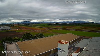

São João da Boa Vista sits at the foothills of the Serra da Mantiqueira in São Paulo state, where the uplands of southeastern Brazil meet the coffee-growing country of the Mogiana region. The city developed in an area shaped by the nineteenth- and early-twentieth-century coffee economy, and coffee remains an important reference point for local rural life and regional identity. Its setting differs markedly from the vast metropolis of São Paulo: rolling inland terrain, farms and smaller urban centres define this part of the state. The Serra da Mantiqueira signals the transition toward higher country near the Minas Gerais border. Browse other webcams across São Paulo state to place this coffee-region setting in a wider geographic context.
2 webcams
São Paulo is best known within Brazil for its influential coffee-growing interior, and Bauru lies in the state’s west-central zone. Set on the plateau of inland São Paulo, the city developed as a railway junction and remains a service, education and commercial centre for neighbouring municipalities. Its waterways belong to the wider Tietê River basin, an important drainage system of southeastern Brazil. Bauru also lends its name to the Bauru sandwich, a Brazilian classic traditionally made with roast beef, melted cheese, tomato and pickled cucumber. Broad avenues, farmland and seasonal tropical weather give the area a character far removed from Brazil’s Atlantic coast. Find related webcams in the surrounding area to build a fuller picture of São Paulo’s interior.
50 webcams
Brazil has served as a Portuguese colonial link between Europe and South America since the 16th century. Its immense territory extends from the Amazon River basin in the north to the Atlantic coast, with the Pantanal wetlands and Brazilian Highlands creating very different regions inland. Rio de Janeiro sits beside Guanabara Bay beneath Sugarloaf Mountain, while Brasília is known for its planned layout and modernist buildings by Oscar Niemeyer. Portuguese is the official language, and football, regional cuisines and Carnival celebrations are central to public life across the country. Continue through nearby webcams to explore different parts of Brazil.
145 webcams