 Kochkor
The broad Kochkor Valley defines the setting of Kochkor — an open highland basin where settlement and pastureland are integral to central Kyrgyzstan. The town is the administrative centre of Kochkor District in Naryn Region, south of Lake Issyk-Kul and on overland routes linking the lake country with the interior. Kochkor is widely associated with Kyrgyz felt handicraft, particularly shyrdak rugs, whose bold interlocking patterns are made through appliqué and stitching. Local workshops and community initiatives help sustain these techniques as both household knowledge and a source of income. Rather than a monumental urban centre, Kochkor is a working regional town where commerce, livestock culture and craft traditions provide a close-scale introduction to Kyrgyzstan’s highland life.
Generated by AI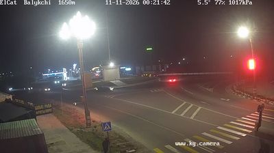

Kochkor combines the practical rhythm of a district centre with enduring nomadic craft traditions, reflecting its position in the broad Kochkor Valley of Naryn Region. Set beside the Kochkor River, the settlement sits in Kyrgyzstan’s highland interior, where livestock herding remains central to local life. Feltwork is a defining local tradition: workshops produce shyrdak rugs, assembled from brightly coloured cut felt in bold geometric patterns. Roads from Kochkor lead towards Song-Köl Lake and Tash Rabat, a stone caravanserai associated with Silk Road routes. Trace Kochkor’s place in the Naryn Region by browsing webcams nearby.
1 webcam
Built around the headwaters and long valley of the Naryn River, Naryn Region grew into Kyrgyzstan’s largest administrative region by area. Much of this central territory lies high in the Tien Shan, where broad valleys, treeless uplands and mountain passes define travel and settlement. The stone caravanserai of Tash Rabat in At-Bashy District recalls the overland routes that linked Central Asia’s trading communities. Around Song-Kul Lake, summer jailoo pastures remain part of a pastoral way of life centred on livestock and seasonal movement. Browse other webcams across Naryn Region to place this mountain setting in a wider Kyrgyz geographic context.
3 webcams
Kyrgyzstan combines enduring nomadic traditions with a Soviet-era urban legacy in a way that reflects its position within Central Asia. The Tian Shan dominates much of the country, with broad valleys, high pastures and Lake Issyk-Kul framed by mountain ranges. Bishkek, the capital, is known for its leafy streets and public squares, while Osh is home to the sacred Sulayman-Too Mountain, a UNESCO World Heritage site. The epic of Manas remains central to Kyrgyz cultural identity, and horseback games such as kok-boru are still widely celebrated. Browse additional webcams from the surrounding area to extend your view of the Tian Shan and Central Asia.
48 webcams