 Daju: Yulong Snow Moutain Parking Lot
Yulong Snow Mountain occupies a high mountain massif in northwestern Yunnan. Rising north of Lijiang, it forms part of the Hengduan Mountains, a complex of deeply cut ranges at the southeastern edge of the Tibetan Plateau. Its highest summit, Shanzidou, reaches 5,596 metres, while lower slopes combine conifer woodland, open grazing land and access roads serving the mountain area. For the Naxi people of the Lijiang region, the massif has long held sacred significance; Naxi traditions are closely associated with the distinctive Dongba script and ritual culture. The parking area is part of the managed approach to this heavily visited alpine landscape, where roads cross broad mountain meadows beneath the ridges.
Generated by AI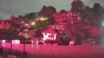

The Jinsha River defines the setting of Daju — its steep, mountain-bound valley has shaped settlement and travel in this rural corner of northwestern Yunnan. Daju lies in Yulong Naxi Autonomous County, near the wider Tiger Leaping Gorge area, where the river cuts between some of southwest China’s most dramatic highland terrain. The community belongs to a region strongly associated with Naxi culture; the Naxi are known for the Dongba writing tradition and distinctive musical heritage. Roads here follow the contours of the valley, linking small settlements with Lijiang’s mountainous hinterland. Continue with other webcams from the area to see how this part of northwestern Yunnan connects regionally.
1 webcam
Mountain ranges and river valleys define much of Yunnan, shaping a province where farming, tea production and transport routes change sharply with altitude. Kunming, the provincial capital, lies near the Stone Forest, a vast karst formation included in UNESCO’s South China Karst World Heritage property. Farther northwest, the upper Yangtze, Mekong and Salween run through parallel valleys in the Hengduan Mountains, a defining feature of the region. Yunnan is home to 25 officially recognised ethnic minority groups, while Pu’er tea takes its name from the city of Pu’er. Continue through nearby webcams to explore different parts of Yunnan.
7 webcams
Built around the Yellow River and Yangtze basins, China grew into a vast modern state with landscapes that run from the Tibetan Plateau and the Himalayas to the Gobi Desert and the shores of the South China Sea. The Yangtze, Asia’s longest river, crosses the country west to east, linking mountain regions with major cities and fertile plains. Beijing’s Forbidden City, the former imperial palace of the Ming and Qing dynasties, remains a defining monument of its long imperial era. The Great Wall follows northern terrain in many separate sections, while regional cuisines, tea traditions and festivals reveal striking local variety. Explore other places across China’s regions to put this setting in a broader geographic context.
190 webcams