 Азеевское сельское поселение: Dajti National Park - Tiranë
Dajti National Park combines wooded mountain slopes with the proximity of Albania’s capital in a way that reflects its position east of Tirana. The park extends across Mount Dajti and the surrounding high ground, where limestone terrain, forest and open upland areas form a marked counterpoint to the built-up Tirana plain. It is a major recreation area for the capital. The Dajti Ekspres cable car connects Tirana’s eastern edge with the mountain, underlining how closely the city and its uplands are linked. Paths and roadside access lead into a landscape used for walking and mountain outings, while the slopes remain an important green boundary above the urban area.
Generated by AI
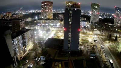


The Moksha River defines the setting of Azeevskoye Rural Settlement — its broad, low-lying valley places the municipality among fields and small settlements in the eastern reaches of Ryazan Oblast. Centred on the village of Azeyevo in Yermishinsky District, this is a quiet borderland near the Republic of Mordovia and within the Oka river basin. Azeyevo has a long-established Tatar community, and the village mosque is a tangible sign of that local identity. Roads, farmland and the river link its dispersed communities more closely than any urban centre. Continue with other webcams from the area to see how this part of Ryazan Oblast connects regionally with Mordovia and the Oka basin.
1 webcam
The terrain of Ryazan Oblast ranges from the flat, pine- and birch-forested Meshchera Lowland in the north to rolling forest-steppe plains in the south, creating a region of wide horizons and river-fed lowlands. The Oka, one of European Russia’s major rivers, crosses the oblast and has long linked its settlements with the Volga basin. Ryazan, the administrative centre, stands on the Oka and is known for the Ryazan Kremlin, whose cathedral ensemble remains the city’s defining historic landmark. Away from the capital, woodlands, meadows and cultivated fields give the oblast a distinctly central-Russian character. Continue to other webcams in Ryazan Oblast to compare landscapes and settings around the Oka basin.
2 webcams
Russia has served as a major power between Europe and Asia since the 16th century. Its territory crosses eleven time zones, extending from the Baltic coast and the East European Plain over the Ural Mountains to the Pacific. The Volga, Europe’s longest river, runs through a core of historic Russian settlement, while Lake Baikal in Siberia is the world’s deepest lake. Moscow’s Kremlin and Red Square stand at the centre of the capital’s political and architectural heritage; Saint Petersburg’s Hermitage Museum occupies the Winter Palace. Orthodox churches, Russian-language literature, ballet and long-distance rail travel remain familiar reference points in a country of immense regional contrasts. Continue with other webcams from Russia to see how this part of northern Eurasia connects regionally.
466 webcams