 Korbielów Górny
 is best known in Poland for its setting beneath Pilsko, one of the highest peaks of the Żywiec Beskids. The scattered settlement stands close to the Slovak border, where homes, fields and clearings occupy the lower ground between forested ridges. Pilsko reaches 1,557 metres and its Polish slopes are home to the Pilsko–Korbielów ski area. The locality belongs to the cultural region of the Żywiec Górale, a highland community whose traditions shape the wider Beskid area. Marked mountain routes also connect Korbielów with the ridge country around Pilsko.
Generated by AI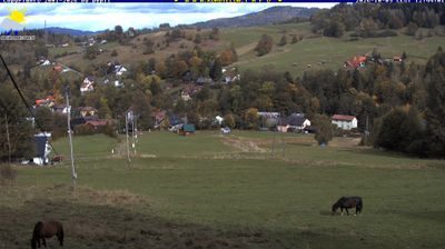





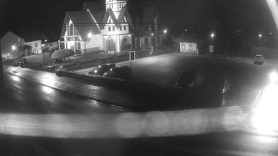

Korbielów Górny straddles the upper valley beneath the Pilsko massif in the Żywiec Beskids of Silesian Voivodeship, and its mountain position has made it a practical starting point for routes toward the Polish-Slovak frontier. Pilsko, one of the highest summits in the Polish Beskids, rises directly above the settlement; forest tracks and marked paths lead into its broad upland slopes. Korbielów is known in Poland as a winter-sports base, while warmer months bring walkers and cyclists to the surrounding Beskid terrain. The area belongs to the historic Żywiec region, where the traditions of the Żywiec highlanders remain part of local identity. Explore nearby webcam locations for complementary perspectives on Pilsko and the Żywiec Beskids.
1 webcam
Among Poland’s voivodeships, the Silesian Voivodeship stands out for its densely populated industrial heartland framed by the Kraków-Częstochowa Upland and the Beskids. Katowice anchors a large urban area whose coal, steel and manufacturing traditions helped shape modern Poland. To the north, Częstochowa is home to the Jasna Góra monastery, a major pilgrimage destination associated with the revered icon of the Black Madonna. The Vistula, Poland’s longest river, rises in the Silesian Beskids near the southern border, where the region shifts into forested mountain country. Explore nearby webcam locations that provide complementary perspectives on the Silesian Voivodeship.
82 webcams
Poland stretches from the Baltic Sea coast in the north to the Carpathian Mountains along its southern frontier, encompassing broad lowlands, lake districts and upland ranges. The Vistula, the country’s longest river, links Kraków and Warsaw before reaching the Baltic near Gdańsk, while the Masurian Lake District is defined by a dense network of lakes. Kraków’s historic centre, including Wawel Castle, recalls Poland’s former royal capital; Warsaw’s rebuilt Old Town speaks to the city’s recovery after the Second World War. The Białowieża Forest preserves one of Europe’s last primeval lowland forests and is home to European bison. Follow how Poland’s regions relate to one another by browsing webcams across the country.
711 webcams