 Hardin
 sits beside Kentucky Lake in western Kentucky, United States, where the Tennessee River widens into a reservoir of wooded inlets and open water. The community is part of Marshall County’s Kentucky Lakes area, shaped by the construction of Kentucky Dam, completed in 1944. That project formed Kentucky Lake, which reaches south into Tennessee and has a notably long, irregular shoreline. Marinas, boat launches and campgrounds are central to local recreation, while the surrounding low hills retain a largely wooded character. Hardin is a quiet lakeside community defined less by urban density than by its connection to one of the region’s major waterways.
Generated by AI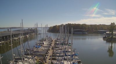


Hardin sits at the eastern edge of Kentucky Lake country in western Kentucky, United States, where the low, rolling farmland of the Jackson Purchase approaches the Tennessee River basin. This small Marshall County community belongs to a region shaped by Kentucky Lake, the reservoir created when the Tennessee River was impounded at Kentucky Dam. Its character is distinctly rural, with fields, local roads and close ties to the lake districts. Kentucky Lake and the nearby Land Between the Lakes National Recreation Area make boating, fishing and woodland recreation central to the wider area. Browse additional webcams from around Kentucky Lake to extend your view of western Kentucky.
1 webcam
The Ohio River and Kentucky’s rolling limestone terrain define much of Kentucky — they support farming, horse breeding and river-linked trade. Mammoth Cave, in the state’s south-central area, is part of the world’s longest known cave system, while the Cumberland Plateau gives eastern Kentucky a more rugged character. Bourbon distilling is closely associated with the state, and Louisville’s Churchill Downs has hosted the Kentucky Derby since 1875. From fertile Bluegrass country to forested uplands, Kentucky connects several distinct American landscapes. See how Kentucky fits within the wider American interior by browsing webcams nearby.
36 webcams
The Atlantic, Pacific and Gulf coasts define much of the United States — their ports, fisheries and trade routes have long tied the country’s economy to the wider world. Between them, the Rocky Mountains, Great Plains and Mississippi River basin form sharply different regions, from high western ranges to broad agricultural heartlands. Cities carry much of the national story: New York’s Statue of Liberty, a gift from France dedicated in 1886, remains an enduring symbol, while Washington, DC concentrates major federal institutions. Indigenous nations have shaped these lands for millennia, and their living cultures remain essential to the country’s identity. Find related webcams in the surrounding areas to build a fuller picture of the United States.
32K webcams