 Helena-West Helena: Historic Helena Steel Bridge
The landscape around Historic Helena Steel Bridge is a low, broad Mississippi River floodplain, which has shaped both the built environment and local life. The crossing belongs to Helena-West Helena’s working riverfront, where the Mississippi forms Arkansas’s eastern boundary and remains a major route for commercial navigation. Levees, wharves and transport corridors on the Arkansas shore reflect a settlement long tied to the river. Helena was an important Civil War site during the 1863 Battle of Helena. Its cultural identity is also closely linked to Delta blues: KFFA’s King Biscuit Time, first broadcast in 1941, has introduced generations of listeners to the music. The bridge connects the Arkansas Delta with Mississippi beside a town whose history has always followed the river.
Generated by AI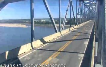




Tucked along the Mississippi River in the Arkansas Delta, Helena-West Helena is a place whose character is shaped by the river’s broad floodplain. The city occupies an old river-port landscape of levees, farmland and low-lying wetlands, close to the meeting of the Mississippi and St. Francis rivers. Blues is central to its public identity: the long-running King Biscuit Time radio program originated in Helena in 1941, while the King Biscuit Blues Festival carries that musical legacy forward. Civil War history is also part of the city’s story; the 1863 Battle of Helena is commemorated through local sites and interpretation. Move on to other webcams in the region to compare landscapes and settings around the Arkansas Delta.
5 webcams
The Arkansas River, the Ozark Plateau and the Ouachita Mountains define much of Arkansas — their waterways, forests and fertile lowlands have long supported farming, timber and river trade. These coordinates lie near Conway in central Arkansas, northwest of Little Rock. Conway is home to the University of Central Arkansas, founded in 1907, and has grown into a regional centre for education and business. Across the state, terrain shifts from the Mississippi Alluvial Plain in the east to higher, wooded country in the west. Browse additional webcams from central Arkansas to extend your view of the Arkansas River country.
33 webcams
The Atlantic, Pacific and Gulf coasts define much of the United States — their ports, fisheries and trade routes have long tied the country’s economy to the wider world. Between them, the Rocky Mountains, Great Plains and Mississippi River basin form sharply different regions, from high western ranges to broad agricultural heartlands. Cities carry much of the national story: New York’s Statue of Liberty, a gift from France dedicated in 1886, remains an enduring symbol, while Washington, DC concentrates major federal institutions. Indigenous nations have shaped these lands for millennia, and their living cultures remain essential to the country’s identity. Find related webcams in the surrounding areas to build a fuller picture of the United States.
32K webcams