 Mokopane: Honeyguide Conservation Lodge - Mmadikiri
Tucked into Limpopo’s Waterberg, Honeyguide Conservation Lodge at Mmadikiri is a place whose character is shaped by rugged escarpments, open bushveld and a waterhole at their foot. The lodge stands in a landscape of rocky slopes, grassland and scattered trees, where the terrain remains the defining feature. Mmadikiri belongs to the wider Waterberg region, an extensive sandstone mountain system in northern South Africa. Its significance extends beyond tourism: the Waterberg Biosphere Reserve was designated by UNESCO in 2001, recognising a region where protected land, rural settlements and working landscapes meet. This is a quieter side of Limpopo, defined less by urban landmarks than by the scale and geology of the Waterberg.
Generated by AI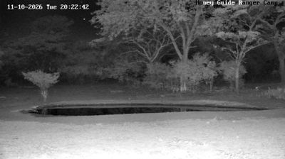

The Waterberg defines the setting of Mokopane — bushveld plains around the town rise toward this ancient mountain region, shaping a hot, semi-arid environment in northern Limpopo. Formerly known as Potgietersrus, Mokopane was renamed in 2003 in honour of King Makopane, a 19th-century Ndebele leader. The town is closely associated with nearby Makapans Valley, where cave sites have produced important archaeological and fossil evidence and form part of the UNESCO Fossil Hominid Sites of South Africa. Farms, bushveld and mining activity mark the surrounding district. Explore nearby webcam locations that provide complementary perspectives on Mokopane, the Waterberg and Limpopo.
1 webcam
Limpopo combines wide, semi-arid bushveld with life-giving river country in a way that reflects its position within South Africa’s northern frontier. The Limpopo River forms much of the province’s boundary with Botswana and Zimbabwe, while the Waterberg range brings a more rugged profile to its west. In the northeast, Kruger National Park protects a major stretch of lowveld habitat and is one of Africa’s best-known wildlife reserves. Limpopo also holds the Mapungubwe Cultural Landscape, a UNESCO World Heritage Site associated with a prosperous Iron Age kingdom that flourished in the 13th century near the Limpopo–Shashe confluence. Browse additional webcams from the surrounding area to extend your view of Limpopo.
4 webcams
The terrain of South Africa ranges from coastal lowlands along the Indian Ocean in the east to high inland plateaus across the centre, producing marked regional climate contrasts. The Drakensberg forms a rugged eastern escarpment, while Atlantic and Indian Ocean shores frame cities including Cape Town and Durban. Table Mountain stands above Cape Town, and the Cape Floristic Region is internationally noted for its exceptional plant diversity. South Africa’s modern identity is inseparable from apartheid and the democratic transition of 1994, a history explored at Johannesburg’s Apartheid Museum. Twelve official languages reflect the country’s diverse communities. Continue through nearby webcams to explore different parts of South Africa.
60 webcams