 Vitória: Jabour
Built around a Portuguese colonial settlement on Ilha de Vitória, Vitória grew into the capital of Espírito Santo. Jabour forms part of the city’s northern urban fabric, where residential streets and small businesses sit within a metropolitan area spread across the island and mainland. Vitória faces Baía de Vitória and the Atlantic Ocean, while mangroves are an important element of its coastal environment. The city was founded in 1551 after the Portuguese moved their colonial seat from Vila Velha to the more defensible island site. Its cultural identity is also tied to the clay cooking pots made in Goiabeiras, used for Espírito Santo’s fish stew, moqueca capixaba. This compact state capital is shaped by water, port activity and dense urban neighbourhoods.
Generated by AI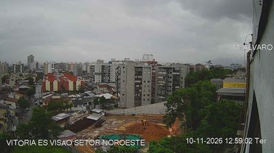

Tucked between the Atlantic coast and Vitória Bay in Espírito Santo, Vitória is a place whose character is shaped by its island setting, tidal waterways and granite hills. Brazil’s smallest state capital occupies Vitória Island and extends onto the mainland, where bridges make the bay part of everyday movement through the city. The historic centre preserves Palácio Anchieta, the state government’s seat, on the site of a Jesuit college founded in the 16th century. Beaches, port facilities and high-rise districts share the shoreline, while Vila Velha faces Vitória across the bay. Find related webcams around Vitória Bay and Espírito Santo to build a fuller picture of this coastal capital.
2 webcams
Espírito Santo balances an Atlantic-facing coast with a mountainous interior in a way that reflects its position between the ocean and Brazil’s southeastern highlands. Its capital, Vitória, occupies an island in a bay along the central coast, while neighbouring Vila Velha is crowned by the Convento da Penha, a major Catholic pilgrimage site founded in the 16th century. Beaches, ports and urban districts line the shore; inland, the Serra do Caparaó reaches toward the state border, and the Doce River crosses the north before meeting the Atlantic. Coffee farming remains an important part of Espírito Santo’s identity, particularly in rural areas. Find related webcams in the surrounding area to build a fuller picture of Espírito Santo.
9 webcams
Brazil has served as a Portuguese colonial link between Europe and South America since the 16th century. Its immense territory extends from the Amazon River basin in the north to the Atlantic coast, with the Pantanal wetlands and Brazilian Highlands creating very different regions inland. Rio de Janeiro sits beside Guanabara Bay beneath Sugarloaf Mountain, while Brasília is known for its planned layout and modernist buildings by Oscar Niemeyer. Portuguese is the official language, and football, regional cuisines and Carnival celebrations are central to public life across the country. Continue through nearby webcams to explore different parts of Brazil.
142 webcams