 Naryn: Lenina Street
Naryn lies along the Naryn River, a compact regional centre enclosed by dry, steep foothills of the central Tien Shan. Lenina Street is one of the city’s principal urban arteries, crossing a centre shaped by broad Soviet-era planning, civic buildings and low-rise neighbourhoods. Founded in 1868 as a Russian military post, Naryn developed into the administrative heart of Naryn Region. Its position in a river valley gives the city a distinctly highland character: everyday traffic and public institutions stand close to open mountain country, while the river corridor defines the settlement’s course.
Generated by AI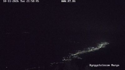

Built around the headwaters and long valley of the Naryn River, Naryn Region grew into Kyrgyzstan’s largest administrative region by area. Much of this central territory lies high in the Tien Shan, where broad valleys, treeless uplands and mountain passes define travel and settlement. The stone caravanserai of Tash Rabat in At-Bashy District recalls the overland routes that linked Central Asia’s trading communities. Around Song-Kul Lake, summer jailoo pastures remain part of a pastoral way of life centred on livestock and seasonal movement. Browse other webcams across Naryn Region to place this mountain setting in a wider Kyrgyz geographic context.
3 webcams
Kyrgyzstan combines enduring nomadic traditions with a Soviet-era urban legacy in a way that reflects its position within Central Asia. The Tian Shan dominates much of the country, with broad valleys, high pastures and Lake Issyk-Kul framed by mountain ranges. Bishkek, the capital, is known for its leafy streets and public squares, while Osh is home to the sacred Sulayman-Too Mountain, a UNESCO World Heritage site. The epic of Manas remains central to Kyrgyz cultural identity, and horseback games such as kok-boru are still widely celebrated. Browse additional webcams from the surrounding area to extend your view of the Tian Shan and Central Asia.
48 webcams