 Jambi: Monument of Keris Siginjai Jambi
Monument of Keris Siginjai Jambi is best known within Jambi, Indonesia, for its monumental keris form, recalling the traditional Malay dagger associated with the province’s cultural identity. It marks a major city roundabout, placing a ceremonial emblem at the heart of Jambi’s modern streetscape. Jambi, a Sumatran provincial capital, stands on the Batanghari River, the longest river on the island. The keris is valued across Indonesia and the wider Malay world as both a weapon and a ceremonial object, while Siginjai is a traditional symbol of Jambi. The monument’s landscaped traffic circle brings regional heritage into the everyday movement of the city.
Generated by AI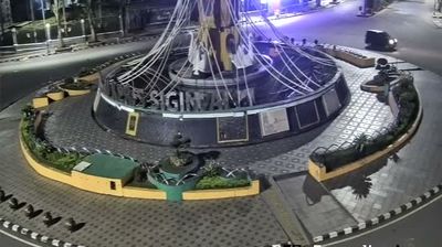
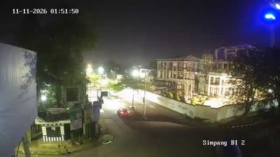

Jambi lies along the Batanghari River, where lowland Sumatran plains extend beside Sumatra’s longest river. As the capital of Jambi province, it is a working river city whose trade and daily life have long been connected to waterways and the island’s interior. The Muaro Jambi Archaeological Site, a wide complex of brick Buddhist structures on the Batanghari, preserves traces of religious and scholarly activity linked to the Srivijaya and Malayu periods. Its temples and earthen mounds add a much older layer to the region beyond the modern city streets. Find related webcams across Jambi province and the Batanghari basin to build a fuller picture of this part of Sumatra.
3 webcams
Jambi stretches from the Barisan Mountains in the west to the wetlands of Sumatra’s eastern lowlands, encompassing rainforest, river plains and peat swamps. The Batanghari, Sumatra’s longest river, crosses the province and has long connected inland communities with the coast. Kerinci Seblat National Park covers a vast highland area in the west, including the slopes of Mount Kerinci. Near Jambi City, the Muaro Jambi temple complex is among Indonesia’s largest Buddhist archaeological sites, reflecting Sumatra’s role in historic regional trade and learning. Discover other points of interest through webcams located across Jambi.
3 webcams
Indonesia has served as a maritime crossroads between the Indian and Pacific oceans since the early centuries of international trade. Its vast archipelago stretches across the equator, linking the volcanoes and rice-growing plains of Java with the rainforests of Borneo and the coral-fringed islands of eastern Indonesia. Java is home to Borobudur, a ninth-century Buddhist temple complex and UNESCO World Heritage Site, while Bali’s Hindu traditions shape daily ceremonies and temple life. Bahasa Indonesia provides a shared national language alongside hundreds of local languages. The Java Sea, Banda Sea and busy straits have long connected islands, ports and cuisines. Browse other webcams across Indonesia’s islands to place this setting in a wider geographic context.
586 webcams