 Sorgun
 combines the brisk pace of a provincial service centre with the broad, open character of the Central Anatolian Plateau in a way that reflects its geographic position in Yozgat Province. The town’s centre is organised around a clock tower and square, where commercial streets, public buildings and mid-rise apartments make a compact urban core. It is one of the principal district towns in Yozgat Province and serves communities across this part of inland Turkey. The plateau setting places Sorgun within the country’s interior, far from the Black Sea and Mediterranean coasts. Its clock tower provides a formal civic landmark amid the contemporary streetscape, while everyday retail and public life give the centre an active, practical character.
Generated by AI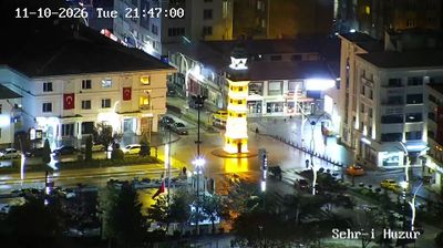


Sorgun is best known in Turkey for its thermal springs. Set on the Bozok Plateau in Central Anatolia, this district town in Yozgat Province is surrounded by the broad, cultivated uplands typical of the region. Its spa facilities make warm-water bathing an important part of local leisure and draw visitors seeking a slower stop beyond Turkey’s major cities. Sorgun also serves as a practical urban centre for nearby rural communities, with everyday markets, cafés and services shaping its rhythm. Continue through nearby webcams to explore different parts of Sorgun and Yozgat Province.
1 webcam
Yozgat stretches from the Bozok Plateau to the Çekerek River basin, encompassing open Central Anatolian uplands, cultivated fields and wooded slopes. The provincial capital stands in Turkey’s interior, where town life reflects the region’s agricultural setting and long road connections across Anatolia. Yozgat Çamlığı National Park, established in 1958 as Turkey’s first national park, protects a remnant stand of Anatolian black pine close to the city. In the centre, the Yozgat Clock Tower, built in 1908, remains a familiar Ottoman-era landmark. Place Yozgat in its Central Anatolian setting by browsing webcams across the surrounding provinces.
3 webcams
Turkey stretches from the Black Sea coast to the Mediterranean shore, encompassing the Anatolian Plateau, rugged mountain belts and the indented Aegean coastline. The Bosporus divides Istanbul between Europe and Asia, while historic districts hold landmarks including Hagia Sophia and the Blue Mosque. Inland, Cappadocia is known for valleys formed in soft volcanic rock and for rock-cut churches; farther west, the ruins of Ephesus recall the country’s place in the classical world. Regional character also defines Turkish cuisine, from Aegean olive-oil dishes to tea served throughout daily life. Continue with other webcams from the area to see how this part of Anatolia and the eastern Mediterranean connects regionally.
65 webcams