 Mount Isa: Leichhardt River
Built around the rich mineral deposits discovered in 1923, Mount Isa grew into one of Australia’s leading mining centres. The Leichhardt River runs through the city before continuing north across inland Queensland toward the Gulf of Carpentaria. Its corridor cuts through open grassland and scattered trees, with roads crossing the watercourse on the edge of the built-up area. Mount Isa Mines, founded in 1924, has long been central to the local economy and identity; its operations are associated with copper, lead, zinc and silver. This remote city is a major service hub for Queensland’s northwest, where mining infrastructure meets the wide, low-relief terrain of the Australian outback.
Generated by AI


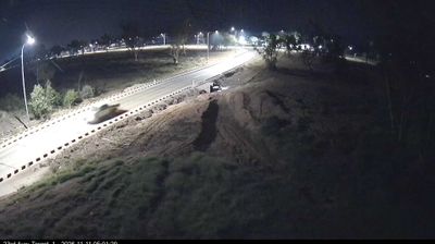

Among the cities of Queensland, Mount Isa stands out for its long-running role as a major mining centre in the inland northwest. The city lies on the Leichhardt River, in a dry outback setting far from Queensland’s coastal metropolises, and its hills bear the marks of mineral extraction. Silver-lead ore was discovered here in 1923 by prospector John Campbell Miles, leading to the establishment of Mount Isa Mines and a settlement that grew around the industry. The Outback at Isa visitor centre interprets this mining story and the wider region, while Lake Moondarra on the city’s outskirts is a local waterside recreation area. Browse additional webcams from the surrounding area to extend your view of Mount Isa and north-west Queensland.
5 webcams
Queensland extends from Torres Strait in the north to the New South Wales border in the south, encompassing a tropical coastline and a vast, dry interior. Along the Coral Sea, the Great Barrier Reef runs beside the state’s eastern shore, while inland plains, grazing country and long distances define much of central and western Queensland. This location lies in the interior, where settlements are widely spaced and open outback horizons contrast with the humid coast. Queensland is home to Aboriginal and Torres Strait Islander peoples, whose enduring connections to Country underpin its cultural identity. Browse additional webcams from central Queensland to extend your view of the state’s interior.
487 webcams
Australia’s terrain extends from tropical rainforests in the northeast to arid plains in the interior, producing dramatic climatic contrasts. The Great Dividing Range follows much of the eastern coast, while the Great Barrier Reef lies off Queensland in the Coral Sea and Uluru rises from the central desert. Aboriginal and Torres Strait Islander peoples maintain living cultures whose connections to Country long predate European settlement. In Sydney, the sail-like Opera House, completed in 1973, stands beside one of the world’s best-known harbours. Discover further points of interest through webcams located across Australia.
1.7K webcams