 Bistrita: Strada Gării
The landscape around Bistrița is hilly and wooded, which has shaped both the built environment and local life. The city stands on the Bistrița River in northern Transylvania, where low ridges frame a dense urban centre of tiled roofs, civic buildings and broad streets. Bistrița developed as an important Saxon trading town in the Middle Ages; its Evangelical Church, with its distinctive tower, remains one of the city’s central landmarks. Strada Gării, or Station Street, belongs to the railway-side part of town, where everyday traffic, apartment blocks and public buildings meet the older fabric. The surrounding hills give this Romanian regional centre a clear sense of enclosure.
Generated by AI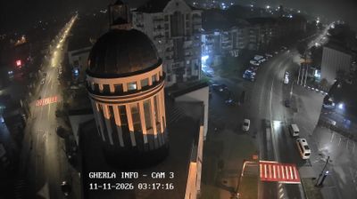

Tucked along the Bistrița River in northern Transylvania, Bistrița is a city whose character is shaped by its position in a broad valley below the Eastern Carpathians. Once an important trading town of the Transylvanian Saxons, it preserves a compact historic centre where the Gothic Evangelical Church rises over Piața Centrală. Streets around the square retain the scale of a medieval market settlement, while the river corridor and nearby hills keep the surrounding landscape close to town. Bistrița is also the principal city of Bistrița-Năsăud County, a region of rural communities and routes leading towards northern Romania’s mountains. Browse additional webcams from the surrounding area to extend your view of Bistrița and northern Transylvania.
1 webcam
Bistrița-Năsăud occupies a northern Transylvanian upland in Romania, where the Someșul Mare River runs west from the Eastern Carpathians toward the Transylvanian Basin. The county combines the broad valley around Bistrița with the Rodna Mountains on its northeastern edge; Pietrosul Rodnei, at 2,303 metres, is their highest summit. Bistrița retains the legacy of its medieval German-speaking Saxon community, notably in the Evangelical Church, whose tower defines the old centre. The former frontier town of Năsăud gives the county its second name and a distinct local identity. Discover other points of interest through webcams located across Bistrița-Năsăud.
1 webcam
The terrain of Romania ranges from the Carpathian Mountains in the centre to the Danube Delta wetlands in the east, creating contrasts between highland forests, fertile plains and reed-filled waterways. The Danube reaches the Black Sea here, and its delta supports abundant bird and aquatic life. Transylvania is marked by medieval towns such as Sibiu and Brașov, while Bucharest is home to the monumental Palace of Parliament, commissioned during the communist era. Orthodox monasteries, folk traditions and regional cuisines add further layers to a country shaped by several historic provinces. Discover other points of interest through webcams located across Romania.
142 webcams