 Wallan: Kilmore Gap Weather Station
Kilmore Gap lies along a low break in Victoria’s Great Dividing Range, where broad grazing paddocks run into rounded ridges above the Wallan district. The area is part of the rural belt north of Melbourne, between the growing township of Wallan and the historic centre of Kilmore. Kilmore Gap Weather Station stands in country shaped chiefly by farming, scattered homes and the north–south transport corridor that includes the Hume Freeway. Wallan sits in the Shire of Mitchell, where townships and farmland mark the transition from Melbourne’s outer fringe to central Victoria. The district forms part of the traditional Country of the Taungurung people, whose connection to central Victoria predates colonial settlement.
Generated by AI

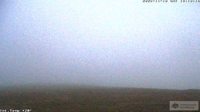





Built around a railway stop on the Melbourne–Sydney corridor, Wallan grew into a rapidly expanding township on Melbourne’s northern fringe. It sits on rolling plains west of the Great Dividing Range, while the Hume Freeway and rail line link it with metropolitan Melbourne and central Victoria. Wallan lies in Taungurung Country, and its identity reflects long Aboriginal custodianship alongside the district’s pastoral and transport history. New neighbourhoods, schools and local services now stand beside open paddocks and rural roads, giving the town a clear transition-zone character. See how Wallan belongs to Victoria’s northern corridor by browsing webcams nearby.
5 webcams
Among Australia’s regions, Victoria stands out for the remarkable variety packed between the Murray River and Bass Strait. The state combines fertile northern plains, the Central Victorian Goldfields, the forested Great Dividing Range and a long southern coast. Bendigo and Ballarat grew rapidly during the gold rushes of the 1850s, while Melbourne developed into Victoria’s cultural and economic centre. Along the southwest, the Great Ocean Road follows a dramatic stretch of coastline, contrasting with the farmland and river country inland. See how Victoria belongs within southeastern Australia by browsing webcams across the region.
326 webcams
Australia’s terrain extends from tropical rainforests in the northeast to arid plains in the interior, producing dramatic climatic contrasts. The Great Dividing Range follows much of the eastern coast, while the Great Barrier Reef lies off Queensland in the Coral Sea and Uluru rises from the central desert. Aboriginal and Torres Strait Islander peoples maintain living cultures whose connections to Country long predate European settlement. In Sydney, the sail-like Opera House, completed in 1973, stands beside one of the world’s best-known harbours. Discover further points of interest through webcams located across Australia.
1.7K webcams