 Selfoss: Markarfljót (Bakkafjöruvegamót)
Skeiðavegamót sits on the lowlands near the Þjórsá River in Iceland’s Southern Region, where Route 1 meets Route 26 and grazing land extends toward broad, low hills. It is a functional crossroads on the island’s south side: the Ring Road links communities around Iceland, while Route 26 leads north towards the interior. Settlement is sparse, with farm fields, shelterbelts and long road corridors shaping the area rather than an urban centre. The continuous Ring Road was completed in 1974, establishing a road connection between Iceland’s regions and making junctions such as Skeiðavegamót part of the country’s essential transport network.
Generated by AI



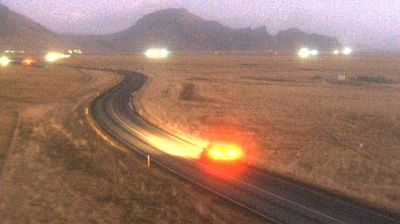


The low-lying plain around Selfoss beside the Ölfusá River is exposed to cool North Atlantic weather, which has shaped both the town’s layout and local economy. Set in Iceland’s southern lowlands, Selfoss serves as a commercial centre for an important farming district, where dairy production, horse breeding and greenhouse cultivation are established activities. The town began to develop after a bridge across the Ölfusá opened in 1891, connecting communities on either bank. Its central location also makes it a useful base for reaching the waterfalls, black-sand coast and volcanic terrain of South Iceland. Discover further places in Iceland’s Southern Region and see how Selfoss fits into the region’s geography.
7 webcams
Iceland’s Southern Region extends from the Atlantic coast to the Vatnajökull ice cap, encompassing black-sand shores, glacial outwash plains and volcanic highlands. This broad part of the country is crossed by rivers descending from the interior, including the Þjórsá, Iceland’s longest river. Vatnajökull National Park protects extensive glacier and volcanic terrain, while the south coast bears the marks of eruptions, floods and ocean weather. Þingvellir, a UNESCO World Heritage Site, is where the Alþingi, Iceland’s parliament, first assembled in 930. Farms and small towns lie between mountains and sea, in a region where conditions can change rapidly. Continue through nearby webcams to explore different parts of Iceland’s Southern Region.
108 webcams
Iceland occupies a volcanic North Atlantic island on the Mid-Atlantic Ridge, between Europe and North America. Glaciers, black-sand shores and active geothermal areas form a terrain in constant dialogue with the weather; Vatnajökull is Europe’s largest glacier by volume. The Golden Circle links Þingvellir National Park, the Geysir geothermal area and Gullfoss waterfall, while Reykjavík concentrates much of the country’s contemporary culture and design. At Þingvellir, the Alþingi first assembled in 930. Fishing, wool knitwear and geothermal energy remain central to Icelandic life. Find related webcams in the surrounding area to build a fuller picture of Iceland.
657 webcams