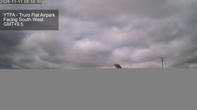
 Hautu Village: YTFA - Truro Flat Airpark -> Facing West
Truro Flat Airpark sits at the eastern edge of the Mount Lofty Ranges in South Australia, where broad agricultural country extends across the inland plains. This small rural airfield belongs to the landscape around Truro, a settlement in the state’s grain-and-grazing belt. Low hangars, open fields and a simple airstrip give the site a practical character shaped by general aviation rather than scheduled transport. Its lightly developed surroundings reflect the scale of South Australia’s farming districts, where properties, roads and service facilities are widely spaced. For aviation-minded travellers, it is a useful reference point for the rural infrastructure that supports private flying in the region.
Generated by AI









The Tongariro volcanic plateau defines the setting of Hautu Village — this inland settlement lies in open central North Island terrain, with Lake Taupō to the northwest and Tongariro National Park to the south. Hautu is part of the wider Turangi area, a service centre for communities around the lake’s southern end. The district is closely associated with Ngāti Tūwharetoa, the iwi whose ancestral connections include Lake Taupō and Tongariro. Tongariro National Park is a UNESCO dual World Heritage site, recognised for volcanic landforms and Māori cultural significance. Browse other webcams across Waikato to place Hautu Village in a wider geographic context.
2 webcams
The terrain of Waikato ranges from fertile river plains around Hamilton to forested ranges on the Coromandel Peninsula to the east, giving the region a varied mix of farmland, waterways and upland country. The Waikato River, New Zealand’s longest, runs through Hamilton and is central to the region’s geography and to Waikato-Tainui, the local Māori iwi. Hamilton is also home to Hamilton Gardens, an extensive public garden complex beside the river. Farther west, the Tasman Sea coast includes black-sand beaches shaped by volcanic material, while the south leads towards the central North Island’s geothermal and volcanic districts. Explore nearby webcam locations that provide complementary perspectives on Waikato.
19 webcams
New Zealand combines Pacific isolation with strong ties to the wider South Pacific in a way that reflects its position between the Tasman Sea and the open Pacific Ocean. The country’s two main islands are divided by Cook Strait, while the Southern Alps run along much of the South Island and include Aoraki / Mount Cook, its highest mountain. On the North Island, volcanic terrain shapes Tongariro National Park and the central plateau; long coastlines frame cities such as Auckland and Wellington. Māori culture is central to national life, and the Treaty of Waitangi, first signed in 1840, remains a foundational document in relations between Māori and the Crown. See how New Zealand fits within the wider South Pacific by browsing webcams nearby.
494 webcams