 Jabiru: Skycam.net.au -> NE
Few places in the Northern Territory have a history as closely tied to the Ranger uranium mine as Jabiru. Established in 1982 as a service town for the mine, Jabiru stands within Kakadu National Park on the traditional lands of the Mirarr people. Its setting is tropical savanna country near the Magela Creek floodplain, part of a vast park recognised by UNESCO for both cultural and natural values. Ranger produced uranium from 1981 until 2021, while Kakadu’s rock art, wetlands and sandstone escarpments reflect a far older, continuing Aboriginal connection to this country. Jabiru Airport is one of the town’s transport links in this remote part of the Top End.
Generated by AI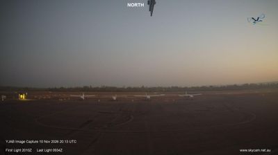

Jabiru sits beside the wetlands of Kakadu National Park in Australia’s Northern Territory, where monsoon rains reshape floodplains between tropical savanna and the Arnhem Land escarpment. The town is the principal service centre for this vast World Heritage-listed park, a landscape cared for by Bininj/Mungguy Traditional Owners. Nearby, the Bowali Visitor Centre introduces Kakadu’s Aboriginal cultures and seasonal ecology, while Ubirr is known for extensive Aboriginal rock art above the Nadab floodplain. Jabiru is also associated with the former Ranger uranium mine, whose rehabilitation remains an important local issue. Browse additional webcams from the surrounding area to extend your view of Kakadu.
2 webcams
Northern Territory runs from the Timor Sea coast to the South Australian border, spanning monsoon wetlands, tropical savanna and the arid Red Centre. Its capital, Darwin, stands on Darwin Harbour, while the immense interior includes the Tanami Desert and the MacDonnell Ranges near Alice Springs. Kakadu National Park is renowned for its wetlands and for one of the world’s greatest concentrations of Aboriginal rock art; Uluru-Kata Tjuta National Park lies farther south. Aboriginal peoples maintain enduring connections to Country across the Territory, whose long roads and distant settlements convey its remarkable scale. Explore nearby webcam locations for complementary perspectives on the Northern Territory.
11 webcams
Australia’s terrain extends from tropical rainforests in the northeast to arid plains in the interior, producing dramatic climatic contrasts. The Great Dividing Range follows much of the eastern coast, while the Great Barrier Reef lies off Queensland in the Coral Sea and Uluru rises from the central desert. Aboriginal and Torres Strait Islander peoples maintain living cultures whose connections to Country long predate European settlement. In Sydney, the sail-like Opera House, completed in 1973, stands beside one of the world’s best-known harbours. Discover further points of interest through webcams located across Australia.
1.6K webcams