 Sabuk-ri
The landscape around Sabuk-ri is formed by densely forested ridges in the Taebaek Mountains, which has shaped both the built environment and local life. This upland settlement belongs to Jeongseon County in Gangwon State, an area long associated with coal mining and mountain communities. Steep, wooded terrain leaves limited level ground for development, so roads and buildings tend to follow the folds of valleys rather than a broad urban grid. The surrounding slopes are part of eastern South Korea’s mountainous interior, where forest remains a defining feature of the setting. Jeongseon is also closely linked with Jeongseon Arirang, a regional form of Korea’s widely known Arirang folk-song tradition. Sabuk-ri sits in a landscape shaped by industry, settlement and highland topography.
Generated by AI
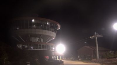

Sabuk-ri lies in a mountain valley of the Taebaek Mountains, where wooded slopes and former coalfields shape the southern Gangwon-do interior. This area of Jeongseon County was profoundly shaped by the rise and decline of South Korea’s coal industry. Its later revival includes Gangwon Land, a casino resort established to support former mining communities, while High1 Resort is nearby in the surrounding highlands. Far from Gangwon-do’s well-known coast, Sabuk-ri represents the province’s elevated, industrial landscape. Explore nearby webcam locations that provide complementary perspectives on Sabuk-ri and the Taebaek Mountains.
2 webcams
Built around the Taebaek Mountains and the upper Han River basin, Gangwon-do grew into South Korea’s broad northeastern province, extending from inland valleys to the East Sea coast. Chuncheon, the provincial capital, lies among lakes and waterways in the west, while the eastern districts meet the sea. Seoraksan National Park gives the region a strongly mountainous character, and winter sports remain an important part of its identity. PyeongChang hosted the 2018 Winter Olympics, bringing worldwide attention to Gangwon-do’s snowy uplands. Buckwheat dishes and fresh coastal seafood also feature prominently in local food traditions. See how Gangwon-do connects with the wider Korean Peninsula by browsing webcams in neighbouring areas.
13 webcams
South Korea stretches from the mountainous border with North Korea to Jeju Island, encompassing forested ranges, fertile river basins and a deeply indented southern coast. The Taebaek Mountains run along much of the east, while the Han River crosses Seoul before reaching the Yellow Sea. Busan faces the Korea Strait, and tidal flats and islands shape the country’s western shore. Seoul combines dense contemporary districts with royal Joseon sites, including Gyeongbokgung Palace, first built in 1395. Kimchi and bibimbap are central to everyday cuisine, while the Korean alphabet, Hangeul, was created in the 15th century. Find related webcams in the surrounding area to build a fuller picture of South Korea’s coasts, mountains and cities.
162 webcams