 Torres
Few places in Rio Grande do Sul have a history as closely tied to the Mampituba River and the Atlantic coast as Torres. The Mampituba marks the border with Santa Catarina before meeting the ocean, and its crossing connects the city with Passo de Torres on the opposite bank. Torres takes its name from dark basalt headlands that interrupt this otherwise low-lying coast: Morro do Farol, Morro das Furnas and Morro da Guarita. Parque Estadual da Guarita protects the latter’s cliffs and coastal vegetation. These formations give the town a markedly different shoreline from much of southern Brazil, while its annual International Balloon Festival is a major event on the regional calendar.
Generated by AI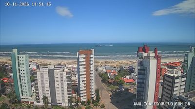

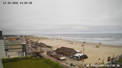
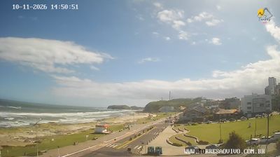

Built around a coastal settlement beneath three basalt headlands, Torres grew into a beach city on Rio Grande do Sul’s Atlantic coast. The Mampituba River meets the sea at the town’s southern edge and marks the border with Santa Catarina. Morro do Farol, Morro das Furnas and Morro da Guarita give Torres a rocky profile uncommon along the state’s long sandy shoreline; the latter lies within Guarita State Park. Beaches, surf and the annual International Balloon Festival shape the city’s seasonal rhythm, while the headlands remain its defining landmarks. Browse additional webcams from the Torres coast and southern Brazil to extend your view of the Atlantic shore.
5 webcams
The terrain of Rio Grande do Sul ranges from Atlantic coastal plains in the east to the open Pampa grasslands of the south and west, creating sharp contrasts within Brazil’s southernmost state. The Serra Gaúcha uplands add a cooler, hillier character in the northeast, while the vast Lagoa dos Patos lagoon shapes much of the coast. Porto Alegre, the state capital, sits beside the Guaíba waterway and is a major cultural and economic centre. Gaúcho traditions remain central to regional identity, especially barbecue culture and rural customs associated with the pampas. Move on to other webcams in the region to compare landscapes and settings around Rio Grande do Sul.
19 webcams
Brazil has served as a Portuguese colonial link between Europe and South America since the 16th century. Its immense territory extends from the Amazon River basin in the north to the Atlantic coast, with the Pantanal wetlands and Brazilian Highlands creating very different regions inland. Rio de Janeiro sits beside Guanabara Bay beneath Sugarloaf Mountain, while Brasília is known for its planned layout and modernist buildings by Oscar Niemeyer. Portuguese is the official language, and football, regional cuisines and Carnival celebrations are central to public life across the country. Continue through nearby webcams to explore different parts of Brazil.
141 webcams