 Rivière-Bonaventure: Tourist resort Pin Rouge
Pin Rouge straddles a forested Appalachian ridge in Gaspésie, where rolling highlands have shaped a compact resort for outdoor recreation. Near Rivière-Bonaventure in eastern Quebec, it is a downhill-skiing area with chairlift-served runs, and its grounds are also used for mountain biking and hiking. Open ski trails cut through mixed woodland typical of the Gaspé Peninsula’s interior edge. Baie des Chaleurs, a broad inlet between Quebec and New Brunswick, is a major natural feature of the wider region. French is the dominant language here, reflected in names such as Rivière-Bonaventure and Baie des Chaleurs.
Generated by AI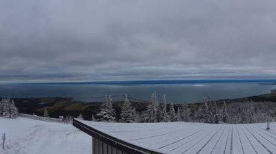

Rivière-Bonaventure lies along the Bonaventure River valley in the interior of Quebec’s Gaspé Peninsula, where forests and watercourses extend north of Chaleur Bay. It is an unorganized territory rather than a town centre, defined less by urban streets than by the river country of the Bonaventure Regional County Municipality. The Bonaventure River is known as an Atlantic salmon river, while the surrounding backcountry forms part of the peninsula’s extensive wooded interior. This is a quiet corner of Gaspésie, set between the St. Lawrence side of the peninsula and the Baie des Chaleurs coast. Continue through nearby webcams to explore different parts of the Gaspé Peninsula.
1 webcam
Quebec has served as a French-speaking heartland within Canada since the 17th century. This vast province stretches from the St. Lawrence River valley to the subarctic north, and the coordinates here lie in its extensive Canadian Shield interior. Boreal forest, lakes, wetlands and rock outcrops shape this sparsely settled part of northern Quebec, where waterways are central to travel and seasonal life. French is Quebec’s official language, while Indigenous nations maintain enduring ties to territories across the province. Quebec City’s historic centre, founded in the early French colonial era, is a UNESCO World Heritage site. Browse additional webcams from the surrounding area to extend your view of northern Quebec.
59 webcams
Canada has served as a frontier between French and British colonial powers since the 17th century. The world’s second-largest country extends from Atlantic shores to the Pacific and Arctic coasts, with the Canadian Shield, the Rocky Mountains, the Great Lakes and the St. Lawrence River shaping its vast geography. First Nations, Inuit and Métis peoples are central to Canada’s identity, while Ottawa’s Parliament Hill represents its federal political life. French remains the official language of Quebec, adding a distinct dimension to the country’s public culture. See how Canada connects across North America by browsing webcams in neighbouring regions.
3.5K webcams