Historical images are not available for this webcam
 Waveland: US 90 at MS 603
Waveland is best known in Mississippi for its shoreline on the Gulf of Mexico. This small Hancock County city lies west of Bay St. Louis, along the coastal corridor of U.S. Route 90, where low-rise businesses and residential streets spread inland from the water. The city was devastated by Hurricane Katrina in 2005, an event that reshaped much of this stretch of the Mississippi Gulf Coast. Waveland’s waterfront setting also places it near the Bay St. Louis Bridge, which carries U.S. 90 across the bay toward its neighboring city. It is a practical coastal community whose broad roads reflect everyday connections between Gulfport, Bay St. Louis and the Louisiana line.
Generated by AI



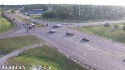

Built around a coastal resort settlement on Mississippi Sound, Waveland grew into a small city on Mississippi’s Gulf Coast. Its shoreline and residential streets lie just west of Bay St. Louis, where the bay opens into the sound. The city’s identity is inseparable from the hurricanes that shape this low-lying coast, particularly Hurricane Katrina in 2005, and from the long process of recovery that followed. Beaches, fishing waters and a relaxed, outdoors-oriented Gulf Coast rhythm define the setting more than a dense urban centre. Browse other webcams across Mississippi’s Gulf Coast to place this setting in a wider geographic context.
5 webcams
Mississippi occupies a broad, low-lying section of the Gulf Coastal Plain in the southeastern United States. The Mississippi River forms much of its western boundary, while the fertile Mississippi Delta lies between that river and the Yazoo River in the northwest. Forests, farmland and slow-moving waterways shape the interior; the state also meets the Gulf of Mexico along its short southern coast. Jackson, the capital, stands on the Pearl River. The Natchez Trace Parkway follows an old travel corridor, and the Delta is closely associated with the development of blues music. Discover other points of interest through webcams located across Mississippi.
441 webcams
The Atlantic, Pacific and Gulf coasts define much of the United States — their ports, fisheries and trade routes have long tied the country’s economy to the wider world. Between them, the Rocky Mountains, Great Plains and Mississippi River basin form sharply different regions, from high western ranges to broad agricultural heartlands. Cities carry much of the national story: New York’s Statue of Liberty, a gift from France dedicated in 1886, remains an enduring symbol, while Washington, DC concentrates major federal institutions. Indigenous nations have shaped these lands for millennia, and their living cultures remain essential to the country’s identity. Find related webcams in the surrounding areas to build a fuller picture of the United States.
32K webcams