 Le Malzieu-Forain: Le Petit Château du Villard
Le Malzieu-Forain has served as a farming commune in the historic Gévaudan region since the French Revolution. It lies in the Margeride, a granitic upland of southern France where rounded, wooded ridges alternate with meadows and cultivated plots. The settlement is dispersed rather than concentrated in a single town centre: stone farm buildings, red-tiled roofs, gardens and small lanes form part of a working rural pattern. This is the inland face of Occitanie, far from its Mediterranean shore, with the landscape shaped by agriculture and forestry. Nearby Le Malzieu-Ville preserves the more urban, walled character once associated with Gévaudan, contrasting with the open countryside of Le Malzieu-Forain.
Generated by AI




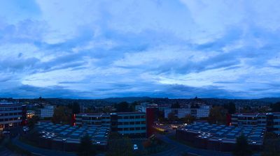

The granite uplands of the Margeride define the setting of Le Malzieu-Forain — pasture, woodland and scattered farms shape a quiet rural rhythm in northern Lozère. The commune lies in the upper basin of the Truyère, within a highland region where winters can be severe and livestock farming remains part of the local economy. Just nearby, Le Malzieu-Ville preserves medieval ramparts and gates, a reminder of the area’s long-established settlement history. Le Malzieu-Forain is well placed for understanding the open, sparsely populated character of Occitanie’s inland mountains. View additional webcams nearby to better understand how the Margeride relates to its surroundings.
1 webcam
Occitania occupies a broad southern belt in France, extending from the Massif Central and the Pyrenees to the Mediterranean coast. These coordinates lie in the inland Haut-Languedoc area, where wooded hills and reservoirs around the upper Agout contrast with coastal plains farther east. Toulouse, the regional capital, stands on the Garonne and is associated with the Canal du Midi, a 17th-century waterway linking the city with the Mediterranean and listed as a UNESCO World Heritage Site since 1996. Roman sites, fortresses connected with the Cathar past, and the Occitan language tradition reveal the many layers of southern French identity. Continue through nearby webcams to explore different parts of Occitania.
214 webcams
The Atlantic and Mediterranean coastlines, together with the Alps, Pyrenees and broad river basins, define much of France — they support maritime trade, farming, wine regions and travel throughout the year. The Seine runs through Paris, where the Eiffel Tower and the Louvre are among Europe’s most recognised landmarks. The Loire Valley is known for Renaissance châteaux, while Mont-Saint-Michel rises from a tidal bay in Normandy. Regional food traditions are equally distinctive, from Breton seafood to Provençal cooking, with bread, cheese and wine central to everyday life. France’s global cultural influence is evident in its language, literature, fashion and cinema. View additional webcams nearby to better understand how France’s coasts, plains and mountain borders relate to their surroundings.
2.1K webcams