 RW 03: Jalan Tol Palembang - Indralaya
Jalan Tol Palembang–Indralaya lies along the Musi River lowlands, a broad, flat corridor between Palembang and Indralaya in South Sumatra. This controlled-access road links the provincial capital with Indralaya, the administrative centre of Ogan Ilir Regency, and forms part of the Trans-Sumatra Toll Road network. It is an important approach to Palembang and Sultan Mahmud Badaruddin II International Airport. Palembang developed on the Musi and is associated with the Srivijaya maritime polity, which flourished in western Indonesia from the 7th century. The route’s divided carriageways run through an outer-urban setting of roadside vegetation, local access roads and expanding settlement.
Generated by AI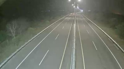







The Musi River defines the setting of RW 03 in Palembang — its broad course through South Sumatra’s capital has long shaped movement, commerce and the city’s spread across both banks. Palembang developed as a river port and was an important centre of the maritime Srivijaya polity, whose influence connected this part of Sumatra with wider Asian trade routes. The Ampera Bridge remains the city’s best-known crossing over the Musi, while local food culture is closely associated with pempek, fish cakes commonly served with a sweet, tangy sauce. Trace RW 03’s place in the wider Palembang area by browsing webcams nearby.
13 webcams
The Musi River and the Barisan Mountains define much of South Sumatra – their contrast between uplands and broad eastern lowlands has long supported farming, trade, and extractive industries. Palembang, the provincial capital on the Musi, was an important centre of the maritime Srivijaya polity and remains the region’s principal city. Its Ampera Bridge is a familiar landmark above the river. Beyond the urban corridor, plantations, wetlands, and coal-producing districts illustrate the province’s varied economy. South Sumatra also has a strong food identity, notably pempek, Palembang’s fish-and-tapioca speciality. Continue with other webcams from the area to see how this part of Sumatra connects regionally.
18 webcams
Indonesia has served as a maritime crossroads between the Indian and Pacific oceans since the early centuries of international trade. Its vast archipelago stretches across the equator, linking the volcanoes and rice-growing plains of Java with the rainforests of Borneo and the coral-fringed islands of eastern Indonesia. Java is home to Borobudur, a ninth-century Buddhist temple complex and UNESCO World Heritage Site, while Bali’s Hindu traditions shape daily ceremonies and temple life. Bahasa Indonesia provides a shared national language alongside hundreds of local languages. The Java Sea, Banda Sea and busy straits have long connected islands, ports and cuisines. Browse other webcams across Indonesia’s islands to place this setting in a wider geographic context.
587 webcams