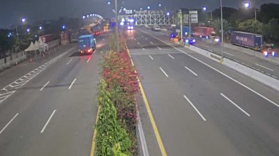
 Jakarta: Jakarta Outer Ring Road East
Jakarta is best known within Indonesia for its role as the nation’s long-standing capital and largest metropolis. The eastern section of the Jakarta Outer Ring Road is part of a tolled orbital network that carries traffic between the city’s outer districts and the wider Jabodetabek urban area. Its broad divided carriageways underline the scale of Jakarta’s built-up edge, where transport corridors, housing and commercial development meet. Jakarta lies on the north-west coast of Java beside the Java Sea and has long been Indonesia’s political and economic centre. In Kota Tua, colonial-era buildings recall Batavia, the headquarters of the Dutch East Indies; the old port of Sunda Kelapa preserves an earlier maritime connection. The ring road helps bind this immense urban region together.
Generated by AI





Jakarta is best known within Indonesia for Monas, the National Monument rising above Merdeka Square. The metropolis occupies a low coastal plain on the northwestern shore of Java, where the Ciliwung River runs toward Jakarta Bay and the Java Sea. Its scale is central to its identity: this is Indonesia’s political, commercial and cultural hub, shaped by centuries of maritime trade and migration. In Kota Tua, former Dutch colonial buildings include the old city hall, now the Jakarta History Museum, while Sunda Kelapa remains a historic harbour for traditional wooden schooners. Browse other webcams across Jakarta and Java to place this setting in a wider geographic context.
19 webcams
Among Indonesia’s regions, Jakarta Special Capital Region stands out for uniting the country’s largest urban centre with the offshore Thousand Islands in the Java Sea. The Thousand Islands Regency, scattered north of the mainland, is administratively part of Jakarta, giving this intensely metropolitan region an unexpected maritime reach. On the city side, the Ciliwung River has long connected inland settlements with the coast. Kota Tua preserves streets and buildings from the Dutch colonial era, while the old port of Sunda Kelapa recalls Jakarta’s role in regional trade. Trace Jakarta’s connection between city streets and the Java Sea by browsing webcams nearby.
21 webcams
Indonesia has served as a maritime crossroads between the Indian and Pacific oceans since the early centuries of international trade. Its vast archipelago stretches across the equator, linking the volcanoes and rice-growing plains of Java with the rainforests of Borneo and the coral-fringed islands of eastern Indonesia. Java is home to Borobudur, a ninth-century Buddhist temple complex and UNESCO World Heritage Site, while Bali’s Hindu traditions shape daily ceremonies and temple life. Bahasa Indonesia provides a shared national language alongside hundreds of local languages. The Java Sea, Banda Sea and busy straits have long connected islands, ports and cuisines. Browse other webcams across Indonesia’s islands to place this setting in a wider geographic context.
587 webcams