 Kendalsari: Sabo Bronggang Argomulyo
Kendalsari straddles the lower slopes of Mount Merapi in Yogyakarta’s northern hinterland, where repeated volcanic activity has shaped the pattern of farms, hamlets and protective infrastructure. Sabo Bronggang Argomulyo is part of a sabo system designed to hold back sediment and debris carried downslope after eruptions, reflecting the practical relationship between local communities and one of Indonesia’s most active volcanoes. Fruit trees, irrigated plots and tiled-roof houses characterize this settled rural belt beneath Merapi. The area belongs to the Special Region of Yogyakarta, whose sultanate remains an important institution in Javanese public life. Kendalsari introduces the everyday landscape beyond Yogyakarta’s urban core.
Generated by AI


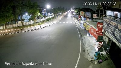


The landscape around Kendalsari is defined by the lower slopes of Mount Merapi, where volcanic terrain has shaped settlement patterns and agriculture. This part of Central Java lies in Merapi’s wider foothill zone, a lived-in rural setting where the volcano remains an important presence in everyday life. South of the mountain, the Prambanan Temple Compounds preserve major Hindu monuments dating from the ninth century and are recognised as a UNESCO World Heritage Site. Kendalsari belongs to a region where volcanic geography and Javanese heritage are closely connected. Move on to other webcams in Central Java to compare volcanic foothills and heritage settings around Kendalsari.
1 webcam
Built around fertile volcanic plains, river basins and ports on the Java Sea, Central Java grew into one of Indonesia’s principal cultural and administrative regions. Its northern coast faces the Java Sea, while the interior rises toward the Dieng Plateau and the volcanic landscapes around Mount Merapi. Semarang, the provincial capital, links the coast to inland towns; its Kota Lama preserves a concentrated quarter of Dutch colonial-era architecture. Near Magelang, the ninth-century Buddhist monument of Borobudur remains the province’s best-known historic site. Javanese court traditions, batik and gamelan are still important parts of regional identity. Move on to other webcams in the region to compare coastal, urban and highland settings around Central Java.
14 webcams
Indonesia has served as a maritime crossroads between the Indian and Pacific oceans since the early centuries of international trade. Its vast archipelago stretches across the equator, linking the volcanoes and rice-growing plains of Java with the rainforests of Borneo and the coral-fringed islands of eastern Indonesia. Java is home to Borobudur, a ninth-century Buddhist temple complex and UNESCO World Heritage Site, while Bali’s Hindu traditions shape daily ceremonies and temple life. Bahasa Indonesia provides a shared national language alongside hundreds of local languages. The Java Sea, Banda Sea and busy straits have long connected islands, ports and cuisines. Browse other webcams across Indonesia’s islands to place this setting in a wider geographic context.
587 webcams