 Miejsce Piastowe
Few places in the Subcarpathian Voivodeship have a history as closely tied to the educational work of Fr Bronisław Markiewicz as Miejsce Piastowe. The settlement lies among the gently rolling foothills of the Carpathians, in the Krosno area of south-eastern Poland. Markiewicz served here as parish priest from 1892 and established an educational institution for disadvantaged young people; his work led to the Michaelite religious congregation. Miejsce Piastowe remains closely associated with Michaelite institutions, while its compact centre of homes, shops and services retains the practical character of a large rural community.
Generated by AI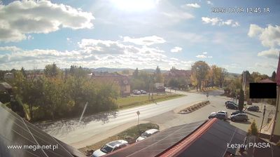




The Lubatówka River defines the setting of Miejsce Piastowe — its shallow valley gives this settlement north of Krosno a gently rolling, low-foothill character and has long concentrated homes, roads and fields along its course. The village lies in Poland’s Subcarpathian Voivodeship, where the Carpathian foothills begin to replace the broader plains farther north. Miejsce Piastowe is closely linked to Blessed Bronisław Markiewicz, who developed his educational and pastoral work here and founded the Congregation of Saint Michael the Archangel. The Michaelite tradition remains an important part of local identity. Browse additional webcams from the Subcarpathian Voivodeship to extend your view of southeastern Poland.
1 webcam
Built around the Carpathian foothills and the upper San River basin, Subcarpathian Voivodeship grew into Poland’s southeastern borderland region. Rzeszów, the regional capital, is its main urban centre, while the land rises southward towards the Low Beskids and Bieszczady Mountains. The San and its tributaries cut through valleys of farmland and forest, linking small towns with the higher Carpathian interior. Wooden Roman Catholic churches and Orthodox tserkvas reflect centuries of Polish and Ukrainian cultural contact, and several local tserkvas form part of a UNESCO World Heritage listing. Continue through the area to see how this part of southeastern Poland connects regionally.
93 webcams
Poland stretches from the Baltic Sea coast in the north to the Carpathian Mountains along its southern frontier, encompassing broad lowlands, lake districts and upland ranges. The Vistula, the country’s longest river, links Kraków and Warsaw before reaching the Baltic near Gdańsk, while the Masurian Lake District is defined by a dense network of lakes. Kraków’s historic centre, including Wawel Castle, recalls Poland’s former royal capital; Warsaw’s rebuilt Old Town speaks to the city’s recovery after the Second World War. The Białowieża Forest preserves one of Europe’s last primeval lowland forests and is home to European bison. Follow how Poland’s regions relate to one another by browsing webcams across the country.
715 webcams